Help me to fund my creation and update of this website. It is my “full time job” and created purely out of love for the subject and I receive no payment so any donation is appreciated! My costs include travelling to our destinations from Dublin, accommodation if we need to stay somewhere nearby, and entrance fees. Your donation could also help with the cost of the occasional book I buy for research (though I mostly use the library – thank you Kevin Street library!). Your donation could also help with my Irish Georgian Society membership or attendance for talks and lectures, or the Historic Houses of Ireland annual conference in Maynooth.
Heywood House in County Laois burned in an accidental fire in 1950, but the demesne is maintained and open to the public. My father, who grew up in nearby Abbeyleix, was at a musical concert with his mother the night of the fire and saw the house burning! At the time, the house was owned by the Salesian order of priests.
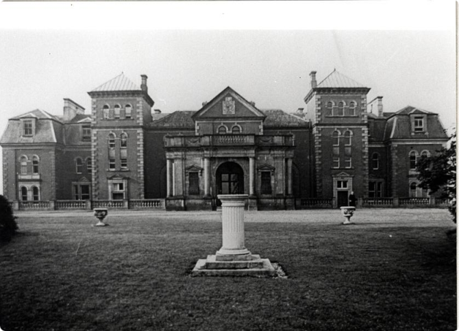
The house was designed by its owner Michael Frederick Trench (1746-1836) in 1770s, with the help of his friend James Gandon who designed, among other buildings, Dublin Custom House. Trench was an amateur architect, and designed the parish church of Swords, as well as an addition to the Rotunda in Dublin. [1]
Michael Frederick Trench (1746-1836) by Hugh Douglas Hamilton, picture courtesy of National Gallery of Ireland, NGI.7773James Gandon (1743-1823), courtesy of National Gallery of Ireland.
Robert O’Byrne tells us in his blog The Irish Aesthete that: “In the early 18th century, a younger son William Trench settled in Laois and acquired land there which was initially developed by his heir, the Rev. Frederick. The English antiquary Owen Brereton wrote of the property in 1763, describing it as ‘a sweet Habitation’ with ’24 Acres Walld round 10 feet high. The ground naturally in fine Slopes and Rising, large trees properly disperst, a River of very clear Water running through it. Pouring Cascades, upon which I counted near 100 Couple of rabbits & 100 of Brace of Hares which are in this Grounds…very extensive Views.’ Both the habitation and the grounds were enlarged by the Rev. Trench’s son Michael Frederick Trench…” [2]
The house was named after Trench’s mother-in-law, Mary Heywood (daughter of a Drogheda merchant). Michael Frederick Trench married Anna Helena Stewart who was the only daughter of Patrick Stewart and Mary Heywood of Killymoon in Co. Tyrone.
Mark Bence-Jones describes the house in his Irish Country Houses (1988):
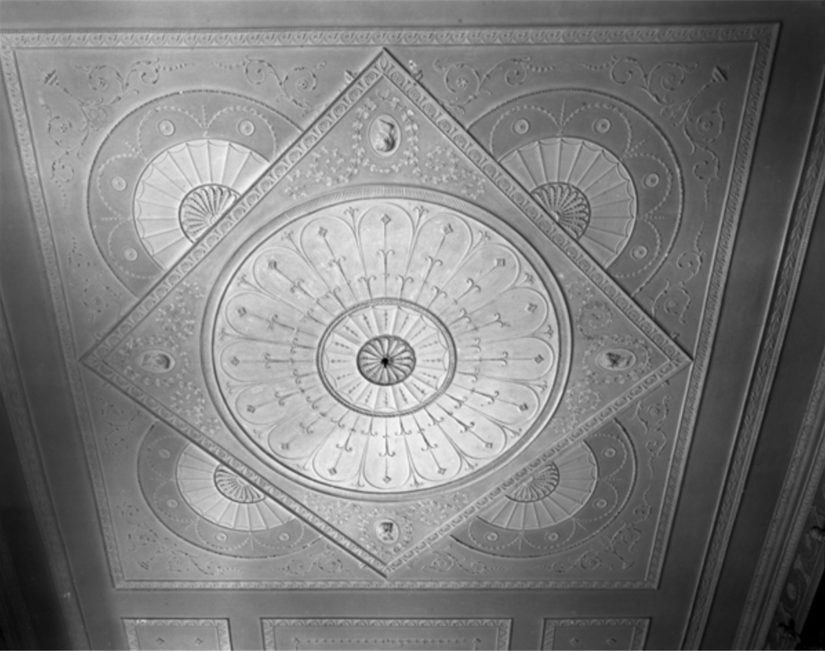
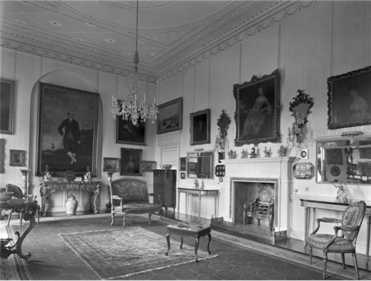
“A house consisting of three storey four bay late C18 centre, with mansard roofed Victorian wings of the same height but in a totally different style. The C18 centre built 1773 by M.F. Trench, who is said to have been the only man who ever called a house after his mother-in-law…The dining room was one of the most accomplished interiors of the Adam period in Ireland, with delicate plasterwork on the ceiling and in panels on the walls.“
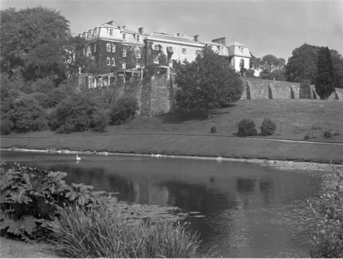
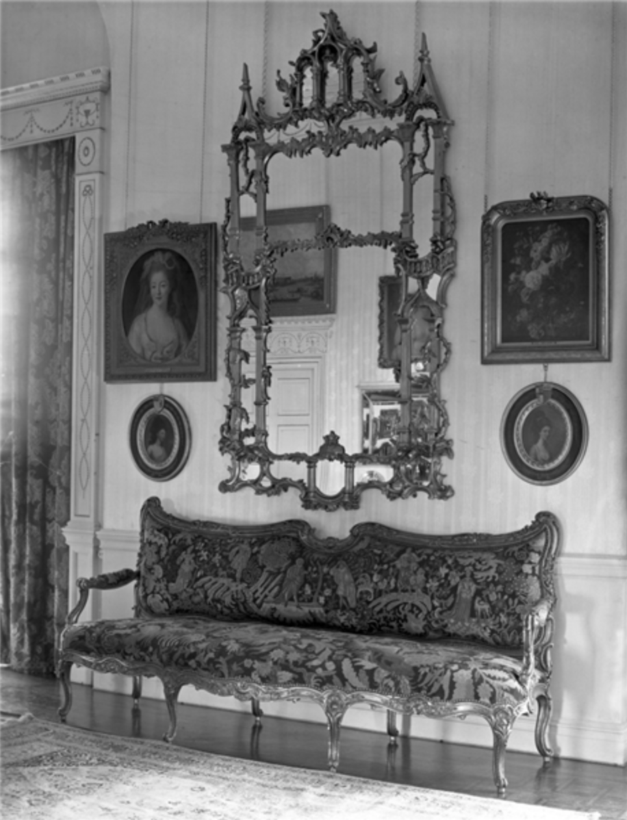
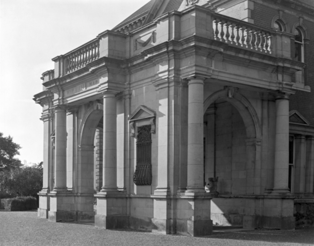
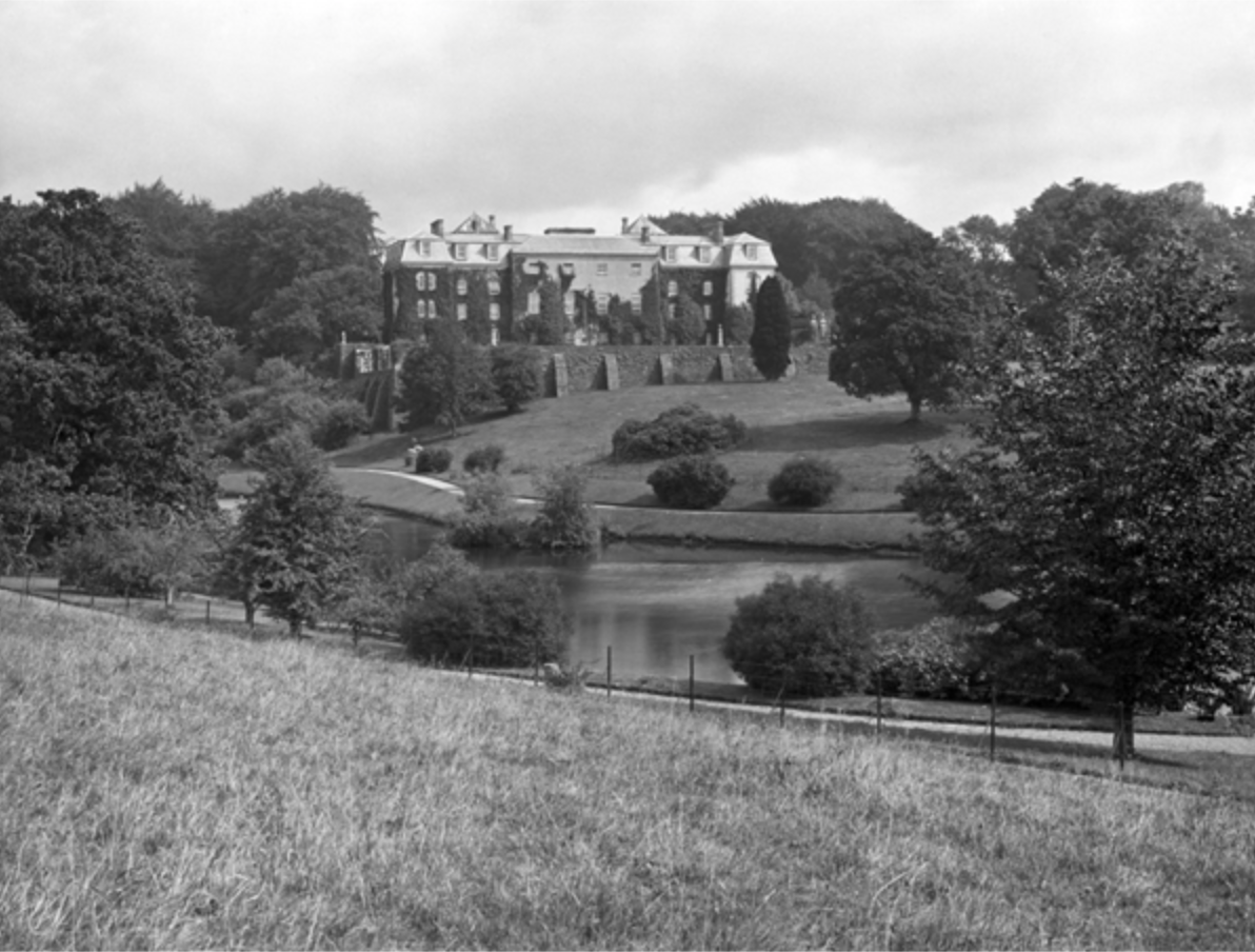
Information board at Heywood, County Laois.Heywood, County Laois, photograph by A.E. Henson, from Country Life, volume XLV, 1919.The dining room at Heywood House,ceiling probably by Michael Stapleton, photograph by A.E. Henson, from Country Life, volume XLV, 1919.Heywood, County Laois, photograph by A.E. Henson, from Country Life, volume XLV, 1919.Heywood, County Laois, photograph by A.E. Henson, from Country Life, volume XLV, 1919.Heywood, County Laois, photograph by A.E. Henson, from Country Life, volume XLV, 1919.Heywood, County Laois, photograph by A.E. Henson, from Country Life, volume XLV, 1919.Heywood, County Laois, photograph by A.E. Henson, from Country Life, volume XLV, 1919.Heywood, County Laois, photograph by A.E. Henson, from Country Life, volume XLV, 1919.
After Michael Frederick Trench built the house, he landscaped the area between his house and the village of Ballinakill, apparently moving hills, digging lakes (he made three artificial lakes), planting trees and placing follies. He created a picturesque garden. The idea of the picturesque first emerges as an idea in late Renaissance in Italy where the term pittoresco began to be used in writing about art. It means that the subject, in this case, the landscape, is “like a traditional picture”. In Holland in the early 17th century a new genre of landscape painting was often referred to as “painter-like” (schilder-achtig). [3] At roughly the same time, French artists Claude Lorraine and Nicholas Poussin painted Arcadian landscapes with classical elements such as ruined temples and mythological figures. These paintings inspired William Kent (c. 1685 – 12 April 1748), an architect, landscape architect and painter. Kent began a style of “natural” gardening that revolutionised the laying out of gardens and estates.
There’s a seat in the gardens called “Claud’s Seat” that may be a tribute to Claude Lorraine.
The landscape gardens designed by Lancelot ‘Capability’ Brown (c. 1716-1783) and his followers were considered to be quintessentially picturesque.
“Capability” Launcelot Brown (1716-1783), Landscape gardener, painting by Nathaniel Dance (later Sir Nathaniel Holland, Bt), c. 1773, courtesy of National Portrait Gallery NPG 6049
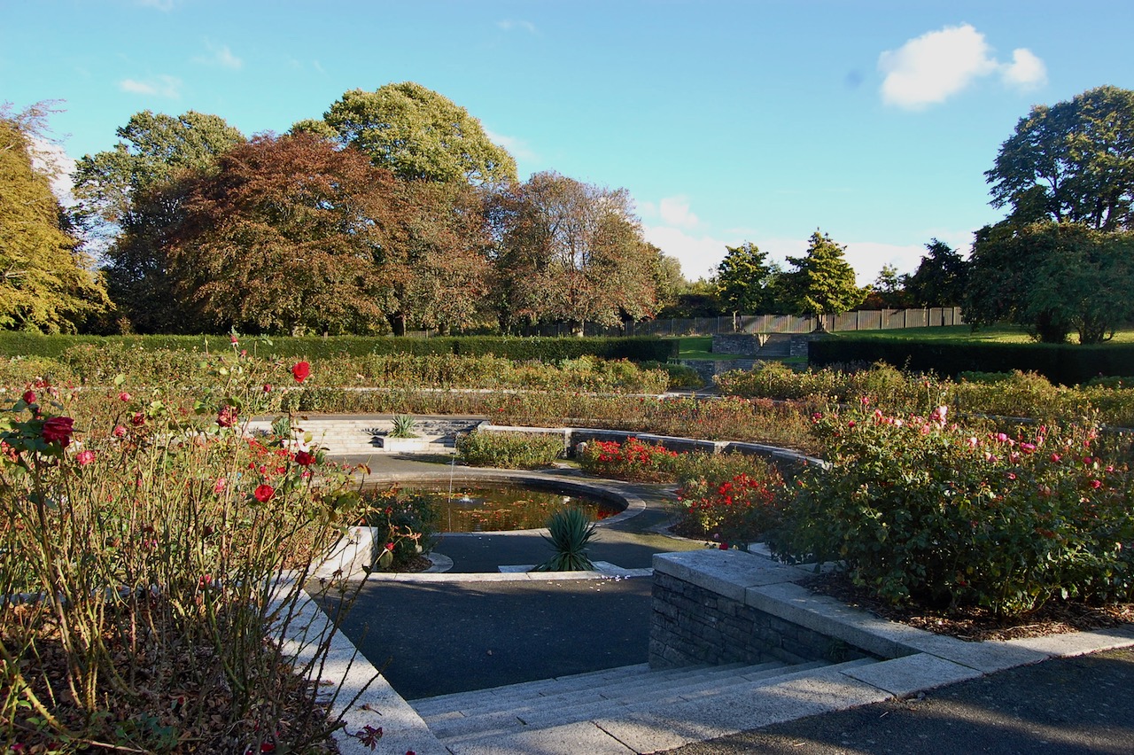
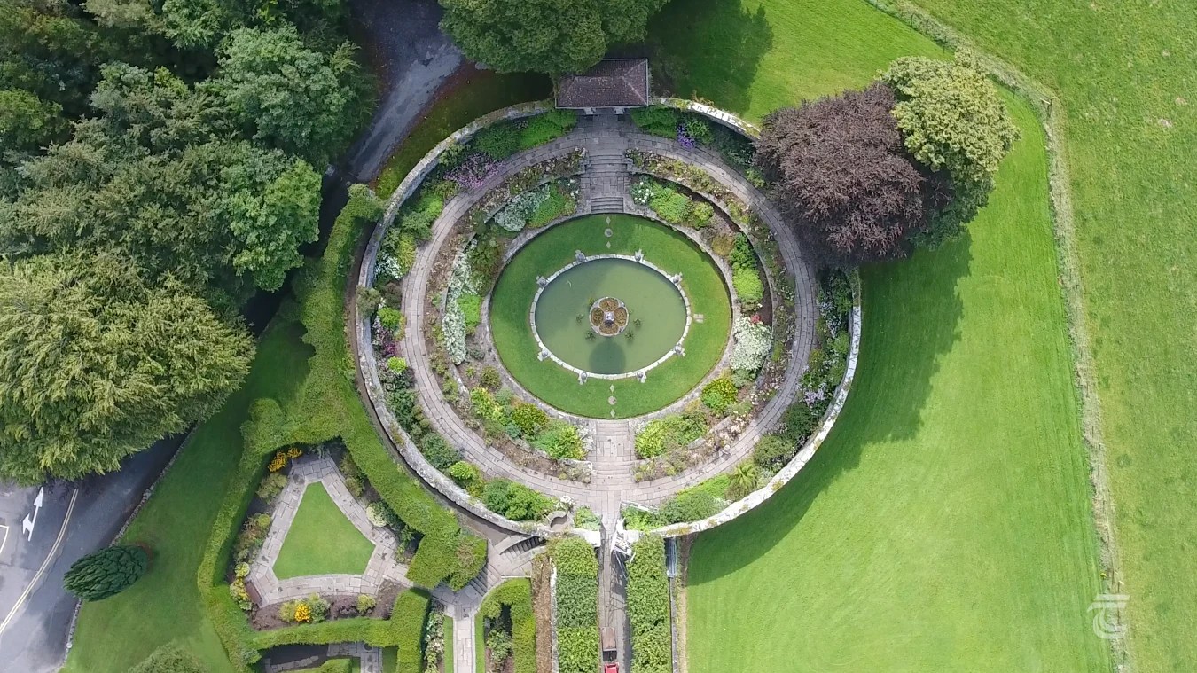
The demesne includes parkland, woodland, a lake, some architectural features and a formal garden by Edwin Lutyens with a beautiful vista, which takes in seven counties!
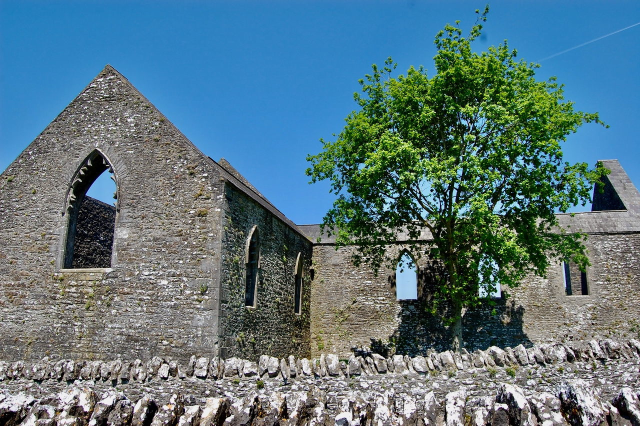
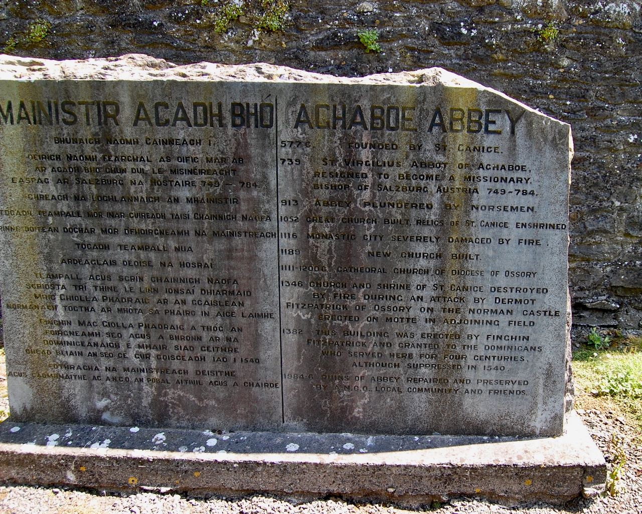
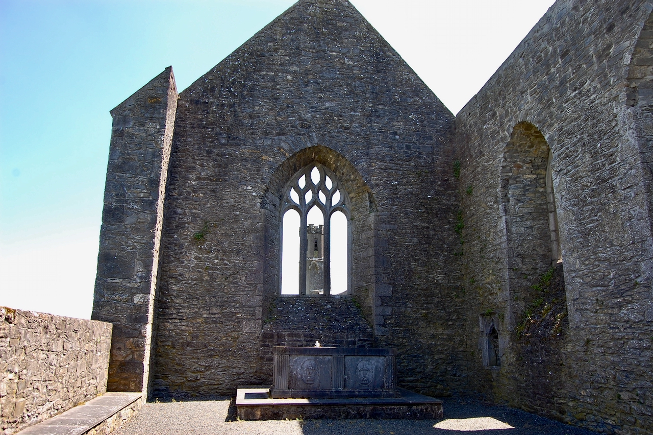
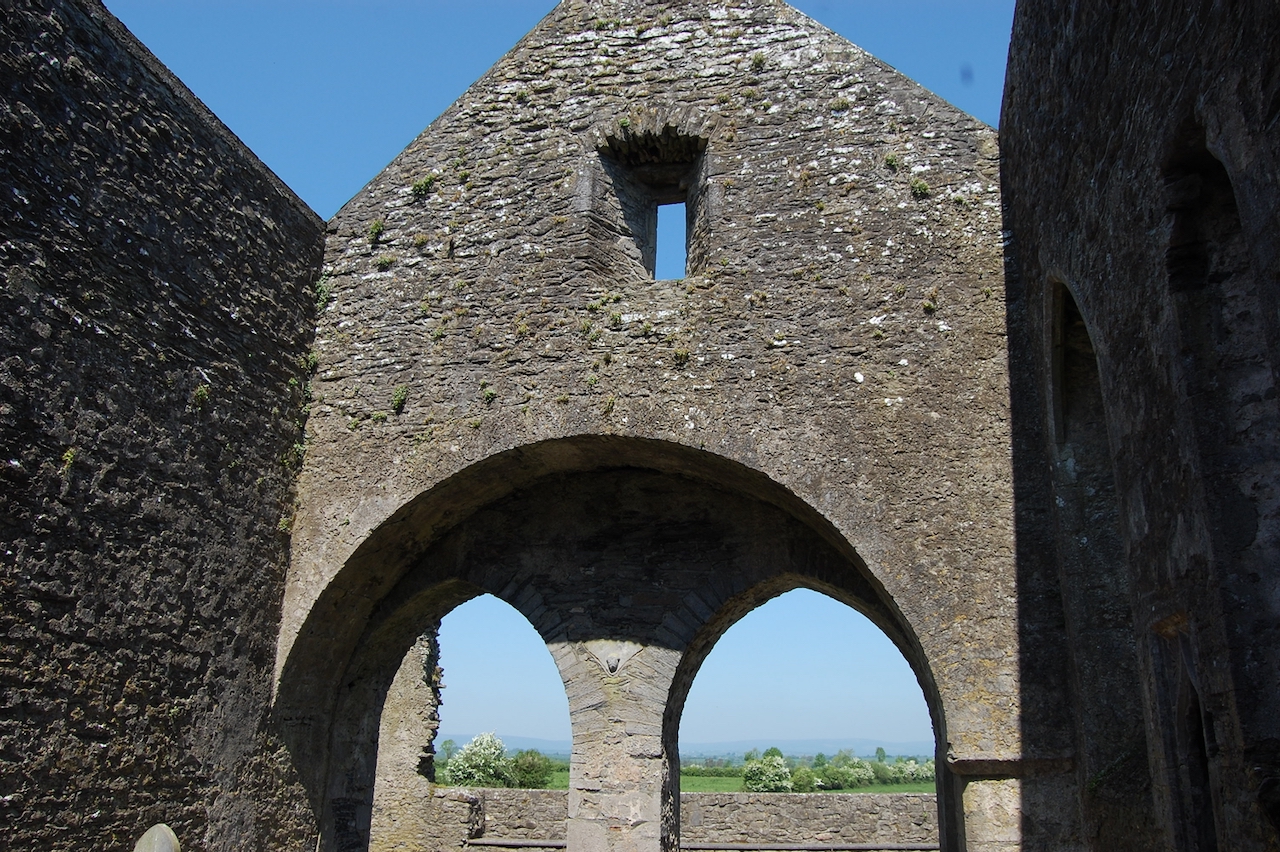
The garden, set within a 250 acre demesne, is, Andrew Tierney claims, the best of its kind in Ireland: a blend of the Arcadian and the Picturesque, above which Edwin Lutyens later erected his walled terraces and enclosures. [4] One of the follies built by the Trenches may contain windows from nearby Aghaboe Abbey. My grandfather purchased property (house and farm) at Aghaboe but the family lost the property when the land was bought by compulsory purchase by the Land Commission in 1977, after my grandfather John Baggot died. I always thought we actually owned the Abbey but that may have been wishful thinking on my Dad’s part.
Michael Frederick’s daughter Helena married Compton Pocklington Domvile, 1st Baronet Domvile, of Templeogue and Santry, Dublin. They had several children, but the house was passed down via their daughter Mary Adelaide, who married Lt-Col William Hutcheson Poë (1848-1934) 1st Baronet.
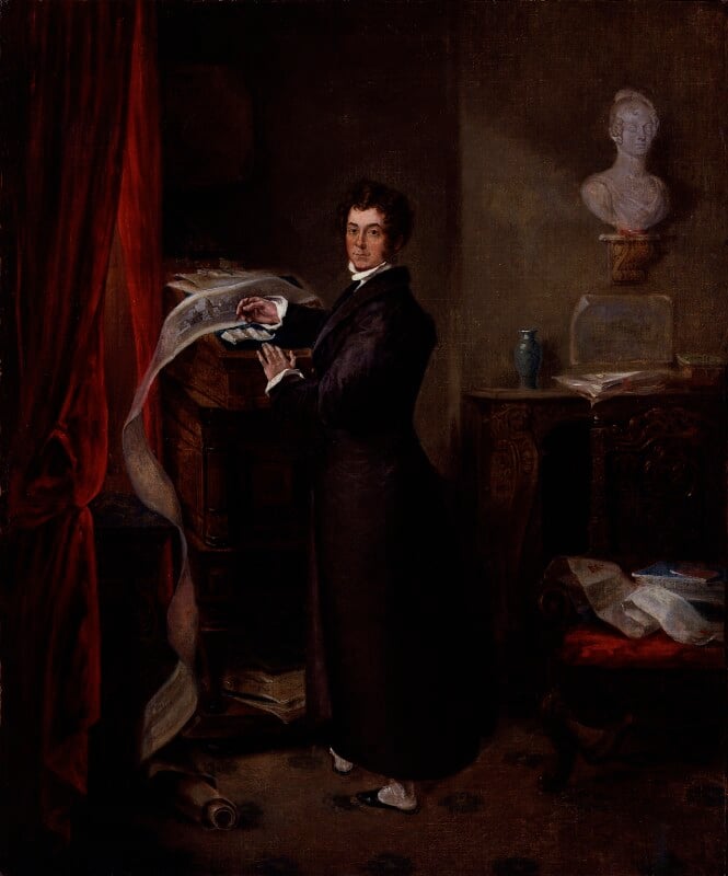
A son of Michael Frederick Trench, this is Frederick Trench (1775-1859). Inscribed on a label on the back: General Sir Frederick Trench/late of Heywood/A prominent promoter of/The Thames Embankment/& other improvements in London. By Unknown artist circa 1827, courtesy National Portrait Gallery 5505. The panorama of the Thames Quay cascading from Trench’s desk appears to stop at St Paul’s and is therefore intended to represent his A Collection of Papers relating to the Thames Quay, with Hints for some further Improvements, illustrated with lithographs by C. M. Baynes and published in 1825, re-issued in 1827. This followed an unsuccessful Bill in Parliament introduced to obtain Treasury support for the project, but in spite of influential backing the plans were dropped and the Embankment was not begun until five years after Trench’s death, with his elegant colonnades omitted. The furnishing of his room includes on a bracket the marble bust by Matthew Wyatt (1826) of Trench’s patron, the Duchess of Rutland, now at Castle Howard. Manuscripts and a William Kent table point to his various antiquarian interests.
Heywood House was enlarged by Lt-Col William Hutchison-Poë in 1875. Around 1906, William Hutchison-Poë hired Edwin Lutyens to create a garden for Heywood.
Information board aboutHeywood, County Laois.
The website tell us that “The architect Sir Edwin Lutyens designed the formal gardens, which are the centrepiece of the property. It is likely that renowned designer Gertrude Jekyll landscaped them.
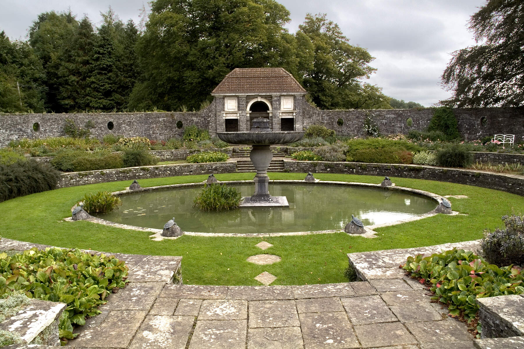
“The gardens are composed of elements linked by a terrace that originally ran along the front of the house. (Sadly, the house is no more.) One of the site’s most unusual features is a sunken garden containing an elongated pool, at whose centre stands a grand fountain.“
Heywood was bought by the Salesian Fathers in 1923, and it was during their time that the fire occurred. It was transferred to State ownership from the Salesian Fathers in November 1993 .
The OPW website tells us “The Heywood experience starts beside the Gate Lodge. Information panels and signage will guide you around the magical Lutyens gardens and the surrounding romantic landscape.“
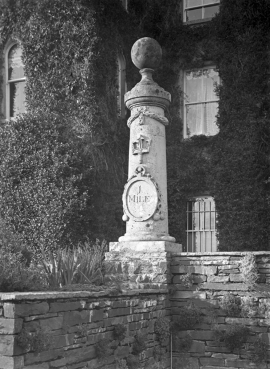
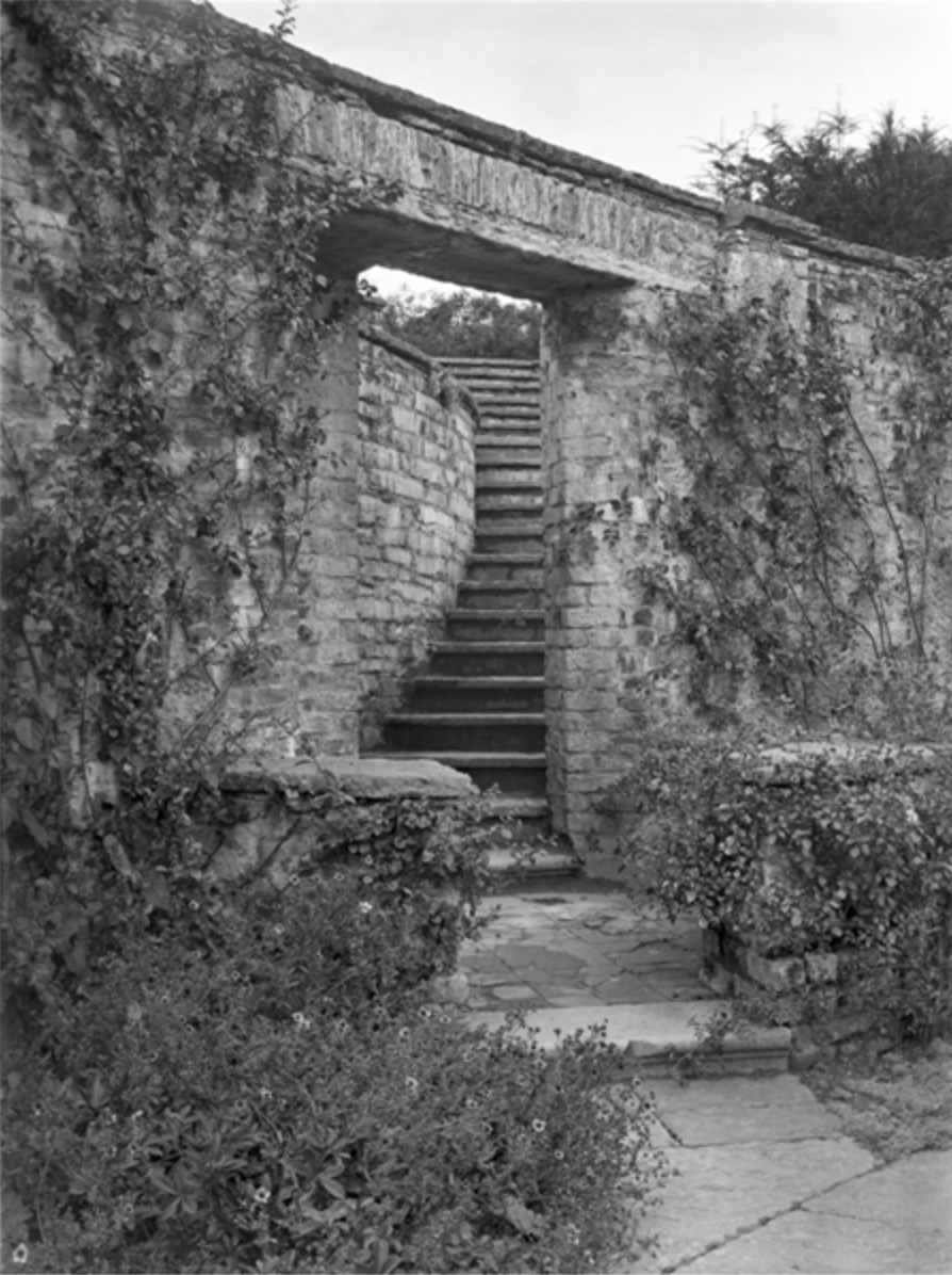
Tierney describes the garden: “The gardens stretch from the principal gates for almost a kilometer and a half, incorporating a sequence of three adjoining lakes and a fourth, further east, and areas of rolling parkland skirted by woodlands. Trench named each part of his garden after Alpine scenery. Trench’s Gothic follies include the Abbeyleix gate, an arrangement of octagonal towers joined by a Tudor-arched gateway. The Trench coat of arms is visible to the right of the gateway arch. From this gate the winding drive opens to Trench’s valley. Nearby, marking a split in the road, is the Spire, a shaft raised in memory of Trench’s friend Andrew Caldwell. Further along is a sham castle. High up behind that is a bridge, and a ruin, on the other side, with the Aghaboe windows. Up the pathway is the Gothic Greenhouse, a brick construction with five lancets with hood mouldings. On the east side of the lake is a grotto or bath house. On the east side of the demesne is the Trench mausoleum.”. [see 4]
Heading toward the Lutyens sunken garden from the Orangerie displays the stunning view, over a lawn of perfect grass. Below the lawn, toward the river, is a trellised walkway, by Lutyens. The house was above. To the east of the house was an alley of “pleached” limes: pleaching means bending and weaving the branches of a row of trees to form a living wall.
Sean O’Reilly describes the Lutyens garden addition:
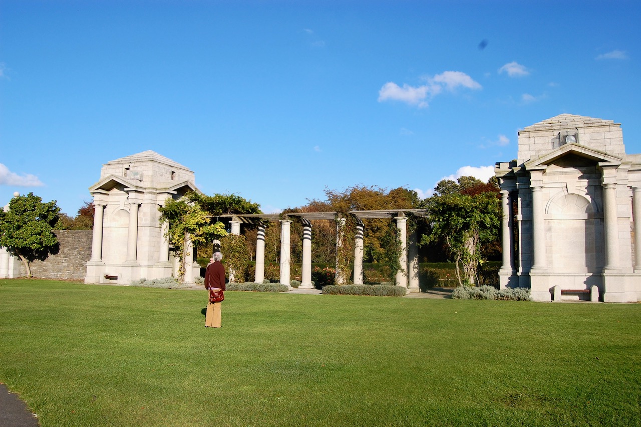
“Lutyens worked on the gardens from about 1906. He complemented the strong architectural framework with an informal planting style, following the same combination of structure and nature developed at Lambay and made popular with his associate – and Country Life author – Gertrude Jekyll. Laying out the garden in a series of terraces and stepped passageways exploding east and west from the falling southern terraces of the house itself, the architect shaped these spaces with a bewildering variety of retaining walls – vertical and battered, stepped and sheer – screen walls – straight and curved, large and dwarf – columns, steps and architectural artifacts.” [5]
The Tuatha website tells us that, sadly, in 1920, Poe’s car was set alight by Republicans when he was returning from a dinner party in Ballyroan. Poe left Heywood a month later, never to return. [6] Perhaps the website is incorrect and it was slightly later, which would make sense, as Poe served as a Senator in the Irish Free State from 1922 to 1925. Many senators had their houses burned by anti-Treaty forces, so burning his car may have occurred for that reason.
In 1941, the house and gardens at Heywood were broken up, and the Salesian Brothers purchased the property. The Salesians are a religious institute founded in the late-19th century by Italian priest, Saint Don Bosco, in order to help children suffering from poverty during the industrial revolution. The Salesians set up a novitiate at Heywood to a train aspirants to the priesthood. They utilised the glasshouses created by Poe to grow fruit and vegetables, with tomatoes, nectarines, peach trees and grape vines.
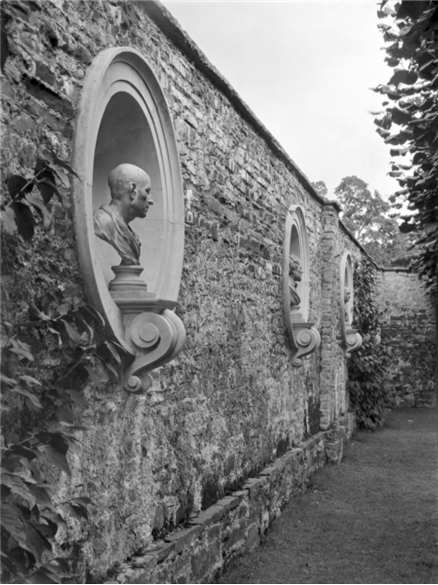
On the east side of the pond Luytens created a Pavilion with Portland stone dressings, terracotta tiled roof and saucer-domed interior, containing two Corinthian capitals rescued by Trench from the Parliament House in Dublin, which he was involved in remodelling. The north wall had busts of philosphers in oval niches, now replaced by urns.
Heywood, County Laois, photograph by A.E. Henson, from Country Life, volume XLV, 1919.
Behind and above the Sunken Garden are a series of “rooms” created by tall hedges and floral planting, stone structures and a suntrap of a seating area.
[1] p. 96. Sadleir, Thomas U. and Page L. Dickinson. Georgian Mansions in Ireland with some account of the evolution af Georgian Architecture and Decoration. Dublin University Press, 1915.
Carlow, Dublin, Kildare, Kilkenny, Laois, Longford, Louth, Meath, Offaly, Westmeath, Wexford and Wicklow are the counties that make up the Leinster region.
I have noticed that an inordinate amount of OPW sites are closed ever since Covid restrictions, if not even before that (as in Emo, which seems to be perpetually closed) [these sites are marked in orange here]. I must write to our Minister for Culture and Heritage to complain.
Laois:
1. Emo Court, County Laois – house closed at present
2. Heywood Gardens, County Laois
Longford:
3. Corlea Trackway Visitor Centre, County Longford
Louth:
4. Carlingford Castle, County Louth
5. Old Mellifont Abbey, County Louth – closed at present
Meath:
6. Battle of the Boyne site, Oldbridge House, County Meath
7. Hill of Tara, County Meath
8. Loughcrew Cairns, County Meath – guides on site from June 16th 2022
9. Newgrange, County Meath
10. Trim Castle, County Meath
Offaly:
11. Clonmacnoise, County Offaly
donation
Help me to pay the entrance fee to one of the houses on this website. This site is created purely out of love for the subject and I receive no payment so any donation is appreciated!
“Emo Court is a quintessential neo-classical mansion, set in the midst of the ancient Slieve Bloom Mountains. The famous architect James Gandon, fresh from his work on the Custom House and the Four Courts in Dublin, set to work on Emo Court in 1790. However, the building that stands now was not completed until some 70 years later [with work by Lewis Vulliamy, a fashionable London architect, who had worked on the Dorchester Hotel in London and Arthur & John Williamson, from Dublin, and later, William Caldbeck].
“The estate was home to the earls of Portarlington until the War of Independence forced them to abandon Ireland for good. The Jesuits moved in some years later [1920] and, as the Novitiate of the Irish Province, the mansion played host to some 500 of the order’s trainees.
“Major Cholmeley-Harrison took over Emo Court in the 1960s and fully restored it [to designs by Sir Albert Richardson]. He opened the beautiful gardens and parkland to the public before finally presenting the entire estate to the people of Ireland in 1994.
“You can now enjoy a tour of the house before relaxing in its charming tearoom. The gardens are a model of neo-classical landscape design, with formal lawns, a lake and woodland walks just waiting to be explored.” [2]
[1] p. 336. Tierney, Andrew. The Buildings of Ireland: Central Leinster: Kildare, Laois and Offaly. Yale University Press, New Haven and London, 2019.
“The entrancing eighteenth-century landscape at Heywood Gardens, near Ballinakill, County Laois, consists of gardens, lakes, woodland and some exciting architectural features. The park is set into a sweeping hillside. The vista to the south-east takes in seven counties.
“The architect Sir Edwin Lutyens designed the formal gardens [around 1906], which are the centrepiece of the property. It is likely that renowned designer Gertrude Jekyll landscaped them.
“The gardens are composed of elements linked by a terrace that originally ran along the front of the house. (Sadly, the house is no more.) One of the site’s most unusual features is a sunken garden containing an elongated pool, at whose centre stands a grand fountain.
“The Heywood experience starts beside the Gate Lodge. Information panels and signage will guide you around the magical Lutyens gardens and the surrounding romantic landscape.“
Longford:
3.Corlea Trackway Visitor Centre, Kenagh, County Longford:
Corlea Trackway Visitor Centre, Co. Longford, photograph by Chris Hill 2018 for Tourism Ireland, Ireland’s Content Pool. [see 6]Corlea Trackway Visitor Centre, Co. Longford, photograph by Chris Hill 2018 for Tourism Ireland, Ireland’s Content Pool. [see 6]
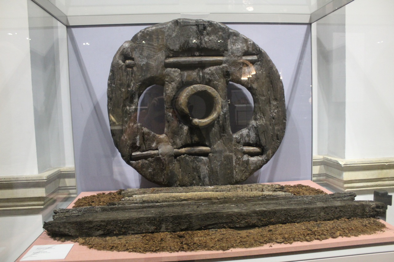
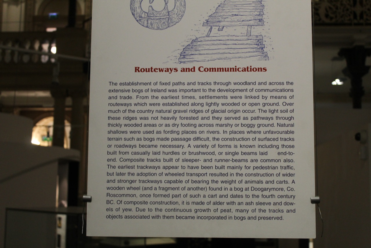
“Hidden away in the boglands of Longford, not far from Kenagh village, is an inspiring relic of prehistory: a togher – an Iron Age road – built in 148 BC. Known locally as the Danes’ Road, it is the largest of its kind to have been uncovered in Europe.
“Historians agree that it was part of a routeway of great importance. It may have been a section of a ceremonial highway connecting the Hill of Uisneach, the ritual centre of Ireland, and the royal site of Rathcroghan.
“The trackway was built from heavy planks of oak, which sank into the peat after a short time. This made it unusable, of course, but also ensured it remained perfectly preserved in the bog for the next two millennia.
“Inside the interpretive centre, an 18-metre stretch of the ancient wooden structure is on permanent display in a hall specially designed to preserve it. Don’t miss this amazing remnant of our ancient past.“
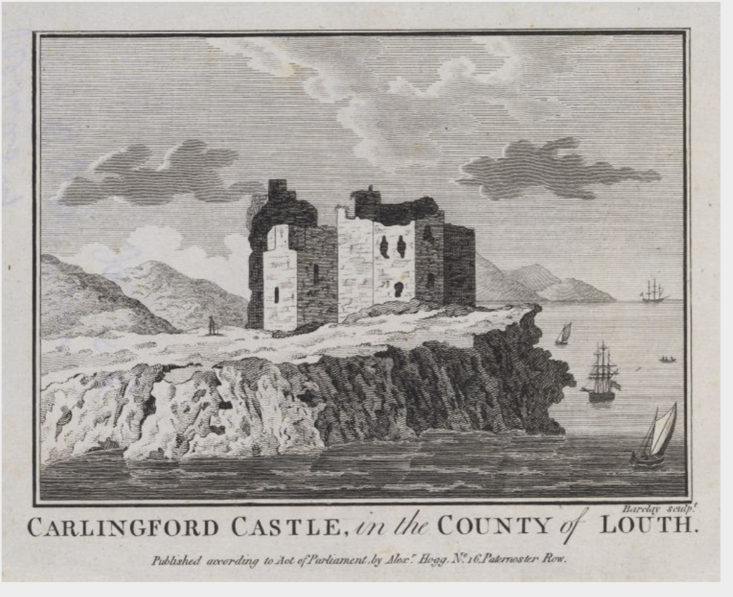
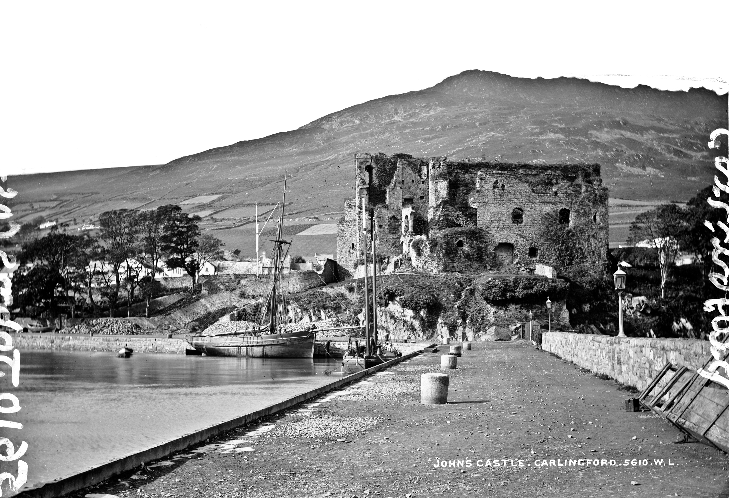
Carlingford Castle, also known as King John’s Castle (not to be confused with the one in Limerick), County Louth, photograph by Brenda Harris 2021 for Fáilte Ireland, Ireland’s Content Pool. [see 6]
“Carlingford lies in the shade of Slieve Foye, a mountain that in legend takes its form from the body of the sleeping giant Finn MacCumhaill. The castle dominates the town and overlooks the lough harbour. It was a vital point of defence for the area for centuries.
“Carlingford Castle was built around 1190, most likely by the Norman baron Hugh de Lacy. By this time Hugh’s family had grown powerful enough to make King John of England uneasy. John forced them into rebellion and seized their property in 1210. He reputedly stayed in his new castle himself. It is still known as King John’s Castle.“
Carlingford Castle, County Louth
“The Jacobites fired on the castle in 1689; William of Orange is said to have accommodated his wounded soldiers there following the Battle of the Boyne.
“Carlingford Lough Heritage Trust provides excellent guided tours of this historic Castle from March to October.“
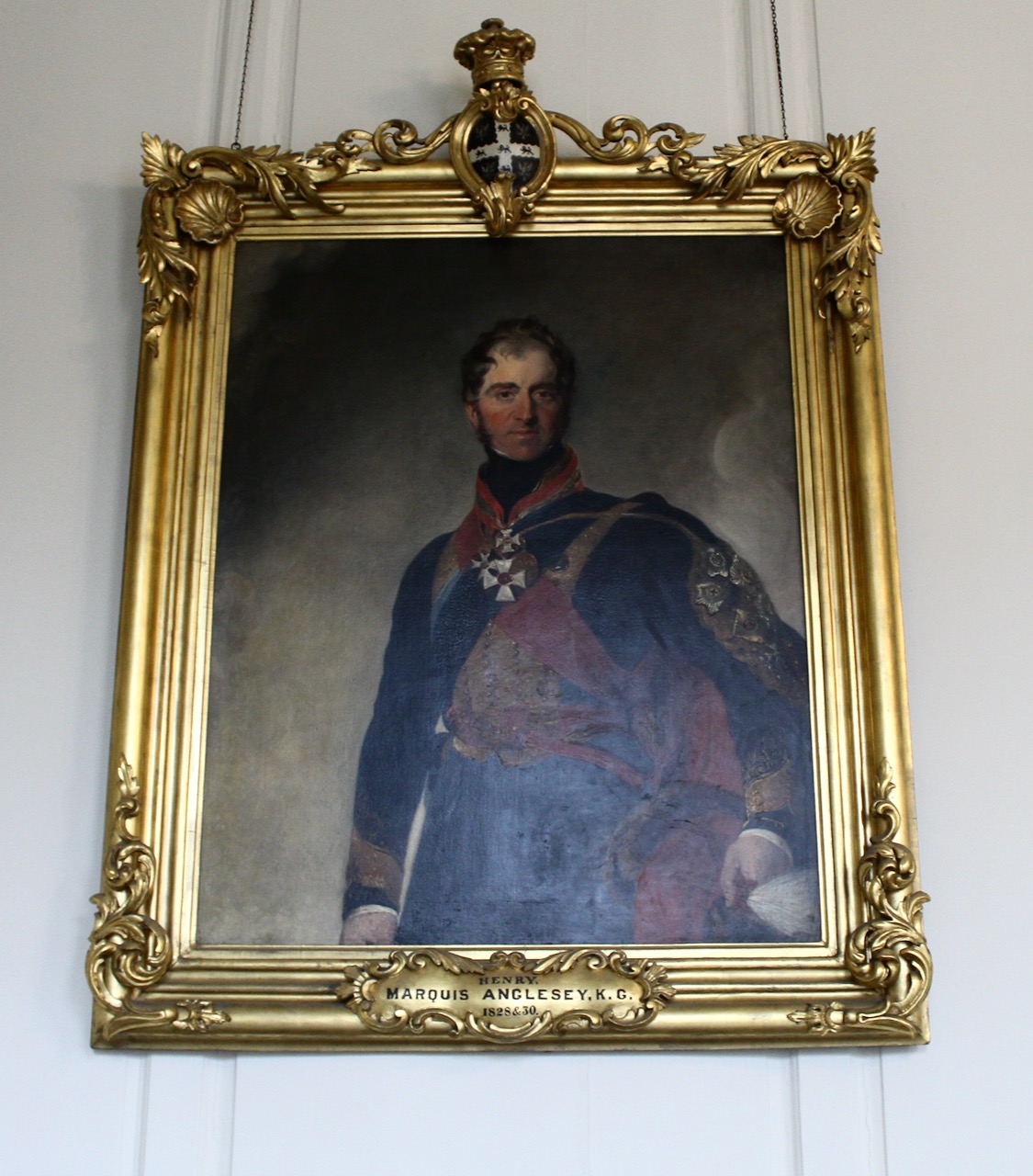
By 1778 the building was ruinous. The task of repair and preservation was begun by the Henry Paget the 1st Marquess of Anglesey in the later nineteenth century (he served as Lord Lieutenant of Ireland from 1848, and as Master General of the Ordinance), and has been continued by the OPW. [13]
Carlingford Castle Co Louth National Library of Ireland by Robert French, Lawrence Photograph Collection.Henry Paget, 1st Marquess of Anglesey (1768-1854), Viceroy in 1828 and 1830.
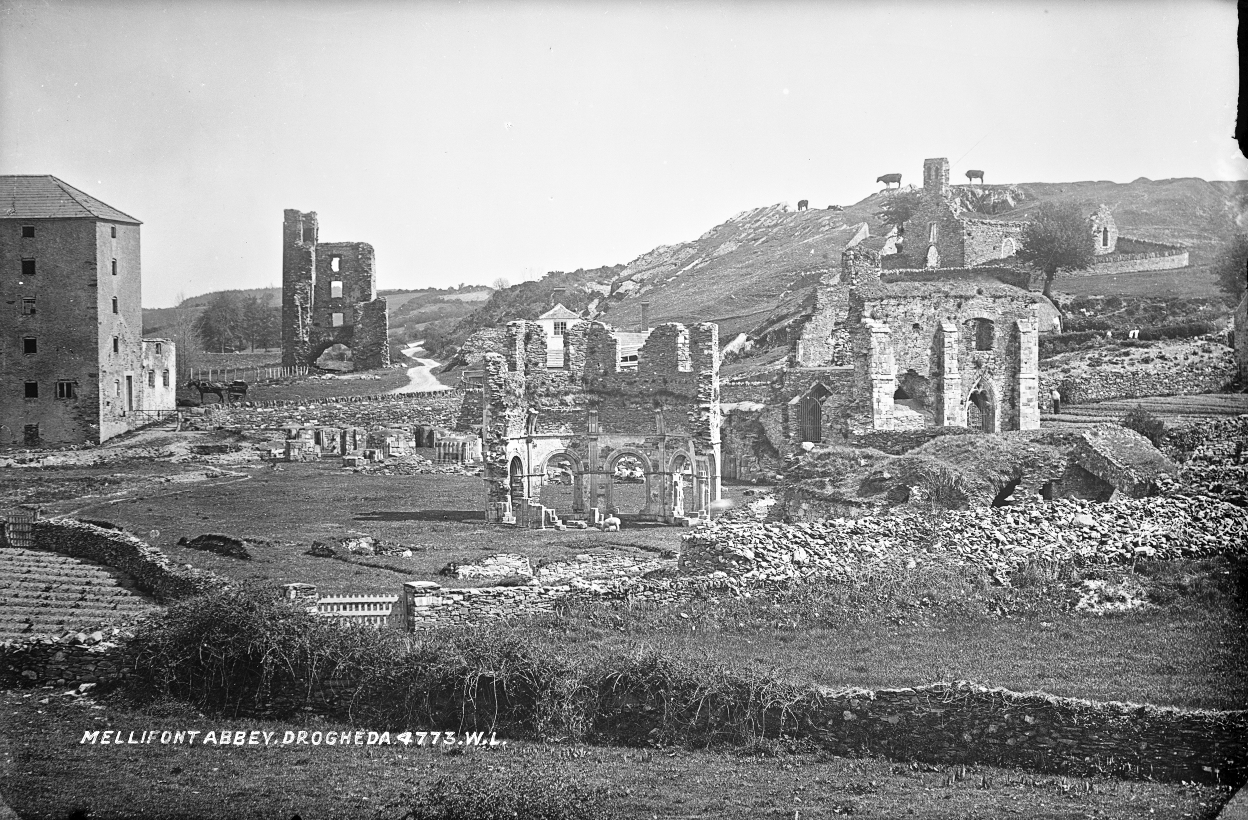
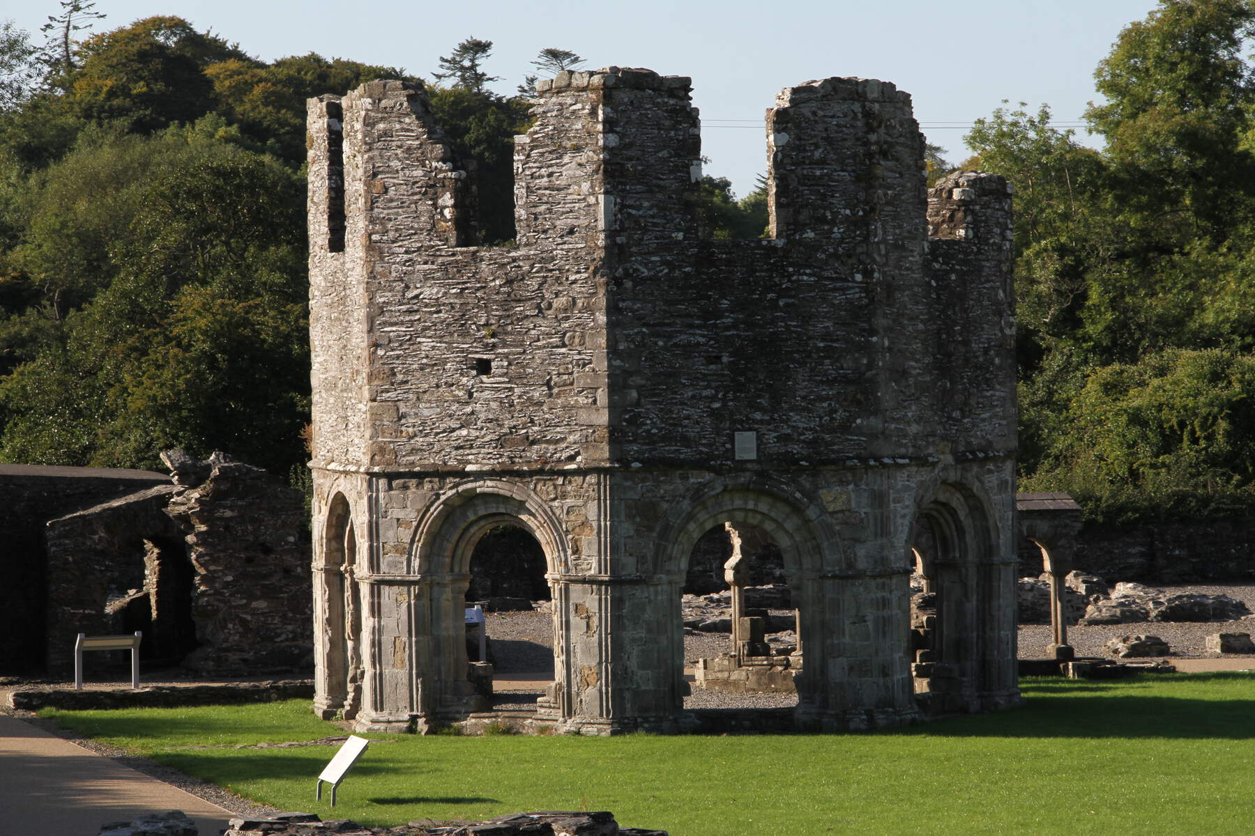
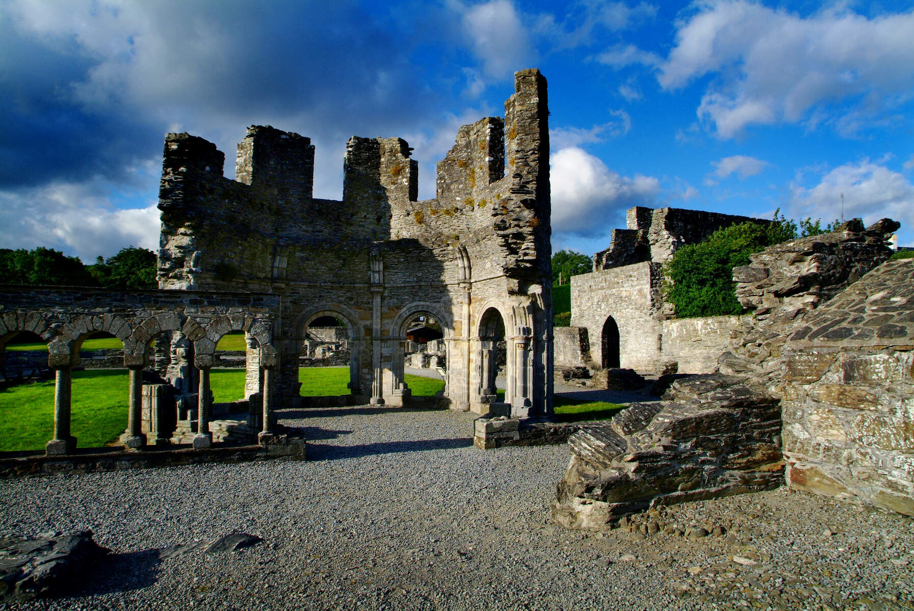
5. Old Mellifont Abbey, Tullyallen, Drogheda, County Louth:
Old Mellifont Abbey, photograph by Eilish Tierney, 2020 for Fáilte Ireland, Ireland’s Content Pool. [see 6]Mellifont Abbey from National Library of Ireland Lawrence photograph collection, flickr constant commons.
General enquiries: 041 982 6459, mellifontabbey@opw.ie. Mellifont means “fountain of honey.”
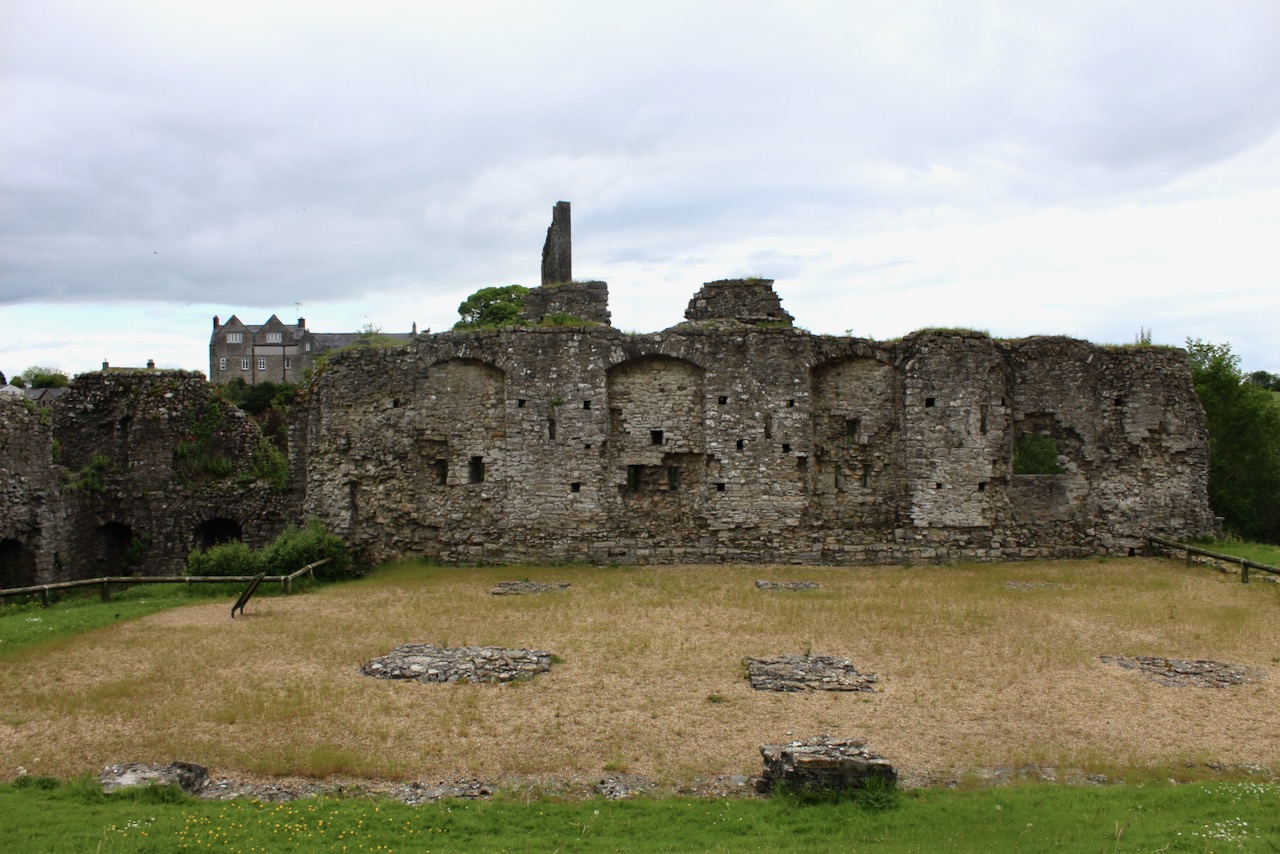
“Mellifont Abbey was the first Cistercian monastery in Ireland. St Malachy of Armagh created it in 1142 with the help of a small number of monks sent by St Bernard from Clairvaux [and with the aid of Donough O’Carroll, King of Oriel – see 14]. The monks did not take well to Ireland and soon returned to France, but the abbey was completed anyway and duly consecrated with great pomp.
“It has several extraordinary architectural features, the foremost of which is the two-storey octagonal lavabo [the monk’s washroom].
“The monks at Mellifont hosted a critical synod in 1152. The abbey was central to the history of later centuries, too, even though it was in private hands by then. The Treaty of Mellifont, which ended the Nine Years War, was signed here in 1603, and William of Orange used the abbey as his headquarters during the momentous Battle of the Boyne.“
Mellifont Abbey ruins, the octagonal lavabo, built in around 1200, photograph by Brian Harte, 2015 for Tourism Ireland, Ireland’s Content Pool. [see 6]
The ruins contain the medieval gatehouse, parish church, chapter house and lavabo. The octagonal lavabo was designed as a freestanding structure of two storeys, with an octagonal cistern to supply the water located at the upper level over the wash room. Wash basins were arranged around a central pier, now gone, which supported the weight of the water above. [14] The entire monastery was surrounded by a defensive wall. After the dissolution of the monasteries, Mellifont was acquired in 1540 by William Brabazon (died 1552), Vice Treasurer of Ireland, and passed later to Edward Moore (Brabazon’s wife Elizabeth Clifford remarried three times after Brabazon’s death, and one of her husbands was Edward Moore), who established a fortified house within the ruins around 1560. His descendents (Viscounts of Drogheda) lived there until 1727 (until the time of Edward Moore, 5th Earl of Drogheda), after which the house, like the abbey, fell into disrepair.
Garret Moore, 1st Viscount of Drogheda, hosted the negotiations which led to the Treaty of Mellifont in 1603.
Mellifont Abbey ruins, photograph by Chris Hill, 2014 for Tourism Ireland, Ireland’s Content Pool. [see 6]
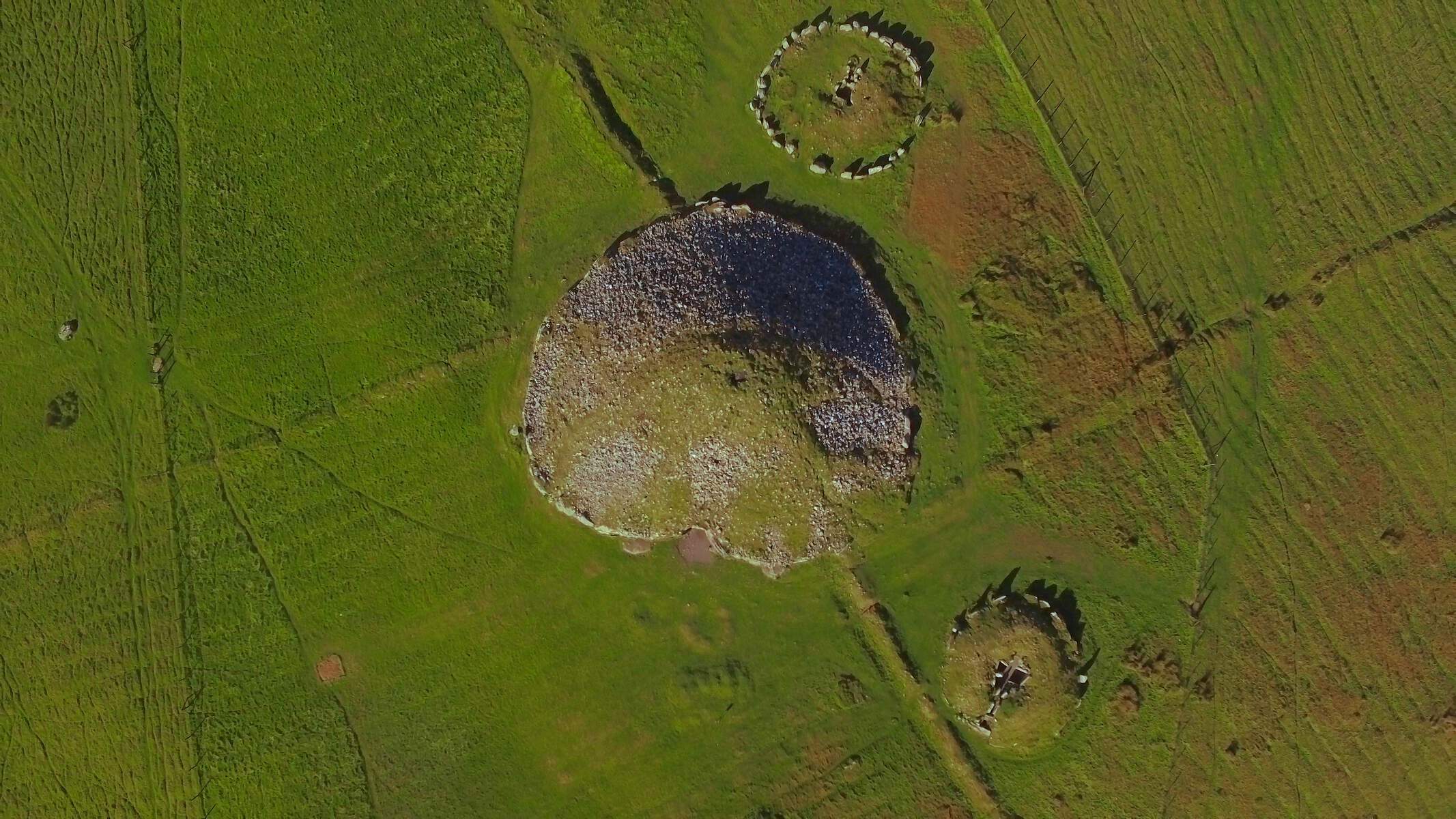
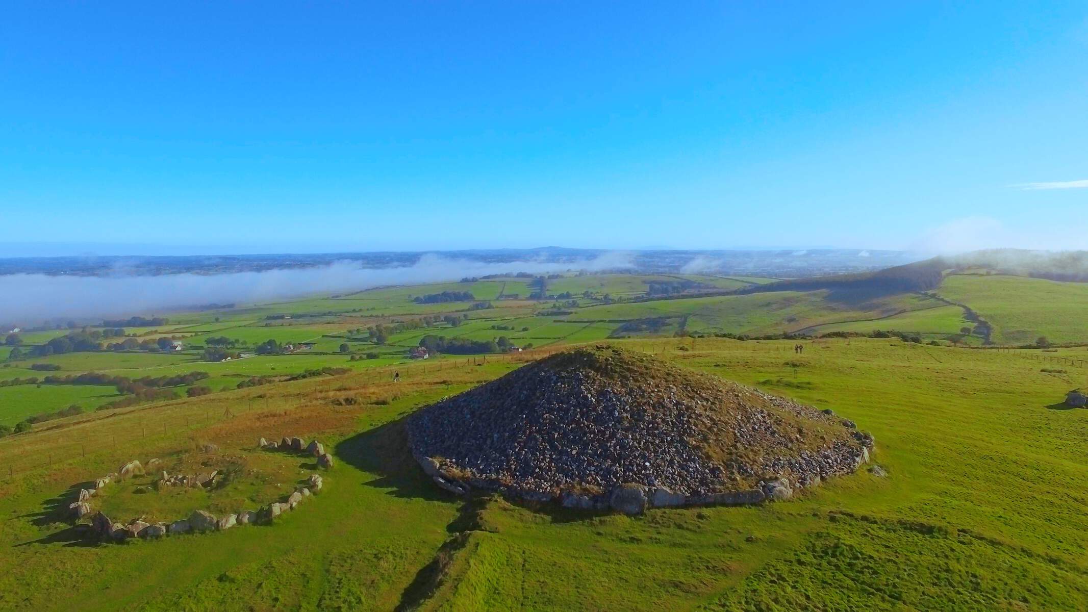
“The Loughcrew cairns, also known as the Hills of the Witch, are a group of Neolithic passage tombs near Oldcastle in County Meath. Spread over four undulating peaks, the tombs are of great antiquity, dating to 3000 BC.
“Cairn T is one of the largest tombs in the complex. Inside it lies a cruciform chamber, a corbelled roof and some of the most beautiful examples of Neolithic art in Ireland. The cairn is aligned to sunrise at the spring and autumn equinoxes and at these times people gather there to greet the first rays of the sun.“
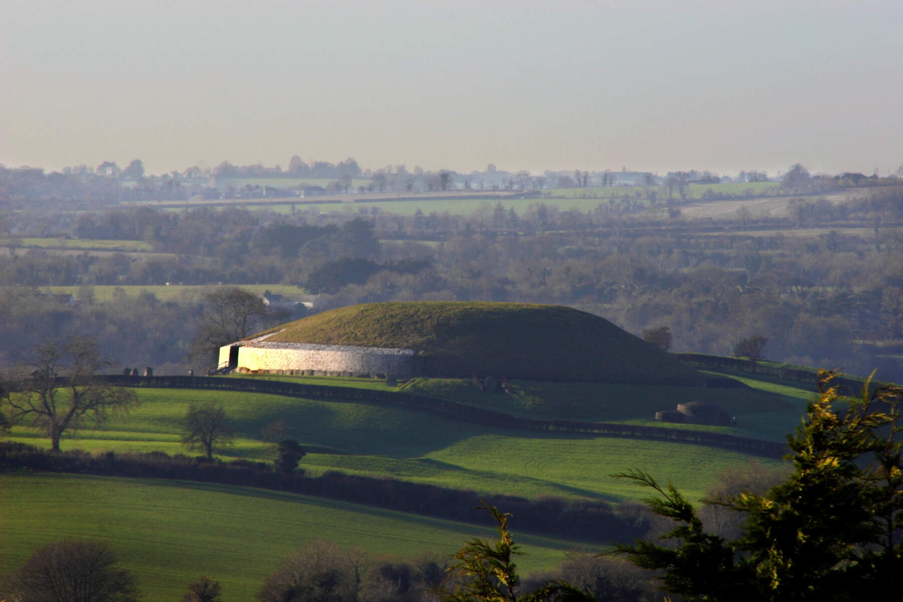
8. Brú na Bóinne Visitor Centre, Newgrange and Knowth, County Meath.
Newgrange, seen from the top of another nearby tumulus, Dowth. Newgrange is a UNESCO World Heritage Site, and dates to some 5,000 years ago…Photograph by Dave Walsh, 2004 for Tourism Ireland. [see 6]
General Information: 041 988 0300, brunaboinne@opw.ie
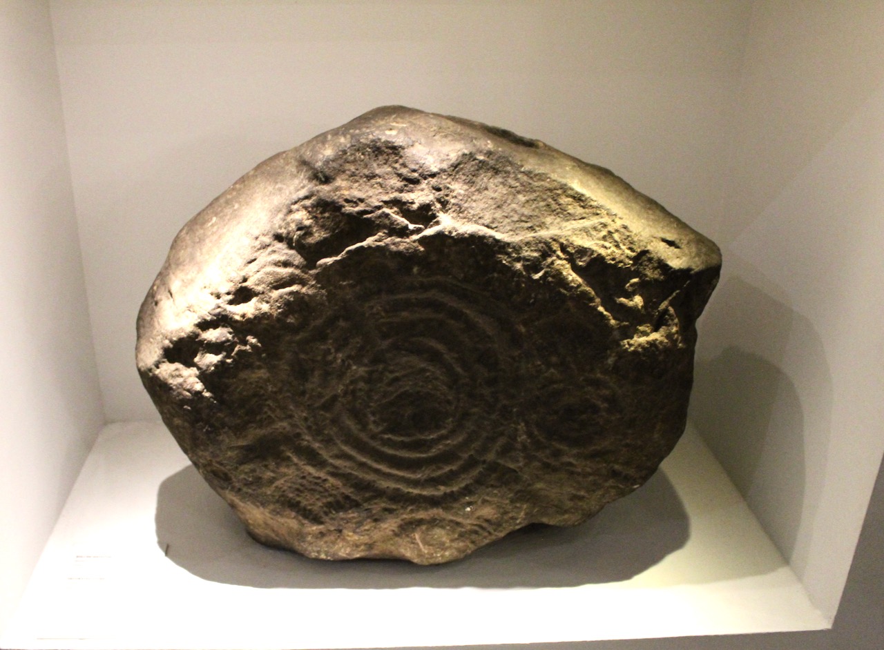
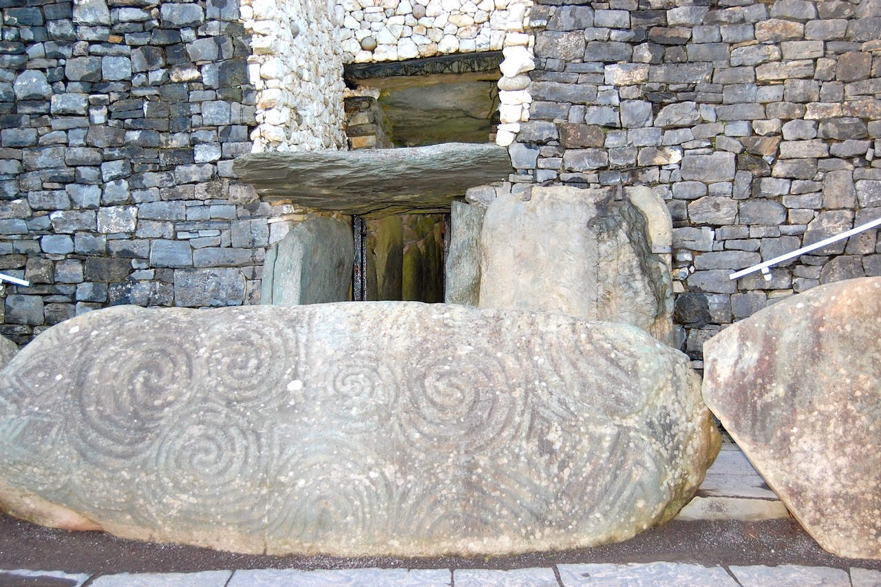
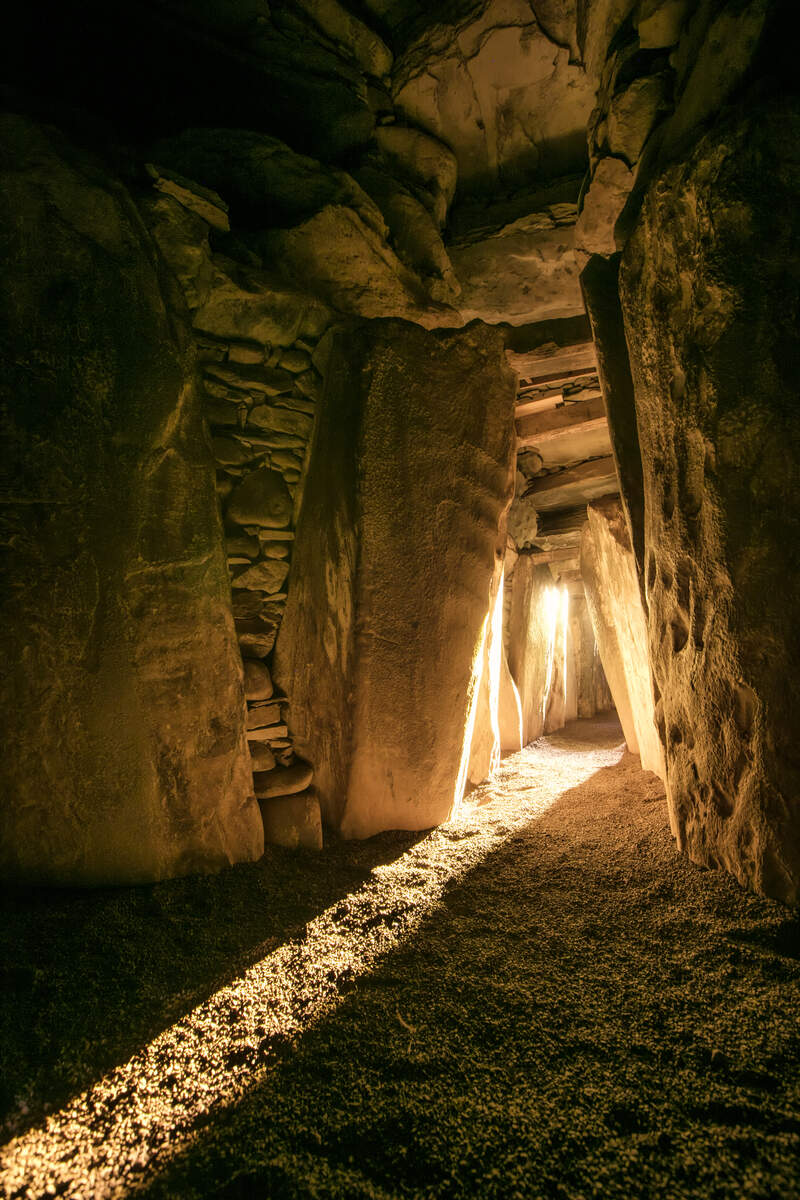
“The World Heritage Site of Brú na Bóinne is Ireland’s richest archaeological landscape and is situated within a bend in the River Boyne. Brú na Bóinne is famous for the spectacular prehistoric passage tombs of Knowth, Newgrange and Dowth which were built circa 3200BC. These ceremonial structures are among the most important Neolithic sites in the world and contain the largest collection of megalithic art in Western Europe.“
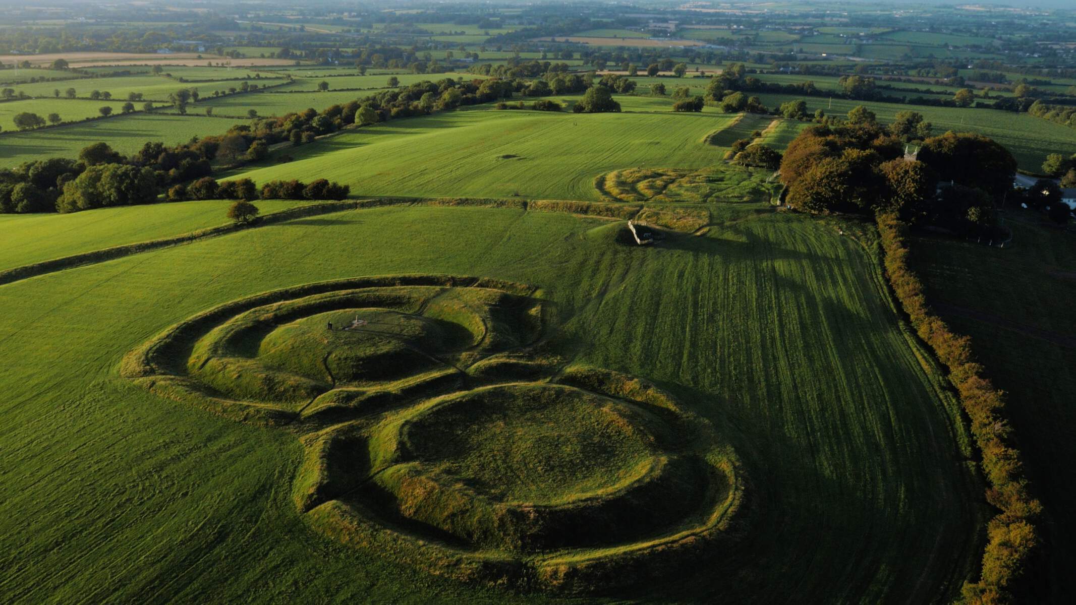
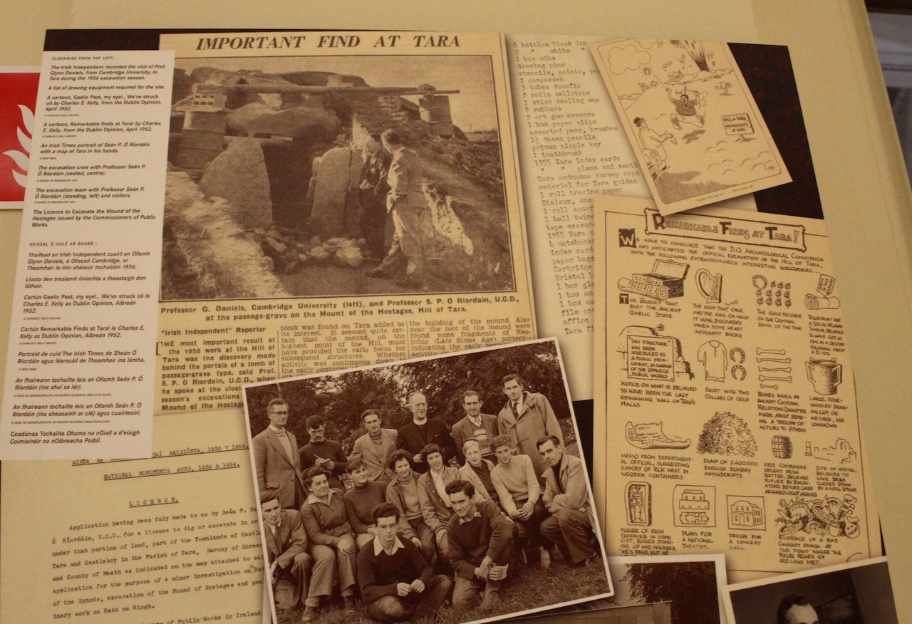
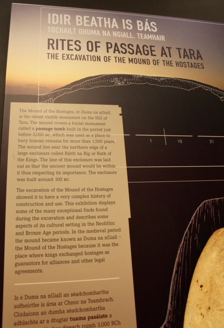
Hill of Tara, County Meath, photograph by macmillan media 2015 for Tourism Ireland, Ireland’s Content Pool. [see 6]Diorama of Tara in the National Museum of Ireland, Kildare Street, Dublin, 2022.Key: 2. Rath/Fort of the Kings, a hilltop enclosure; 3: Royal Seat, a barrow; 4. Cormac’s House, a ringfort; 5. Stone of Destiny, Liah Fail, a standing stone; 6. Mound of the Hostages, a passage tomb; 7. Rath of the Synods, an enclosure; 8. Banqueting Hall, a linear earthwork.
General information: 046 902 5903, hilloftara@opw.ie
From the OPW website:
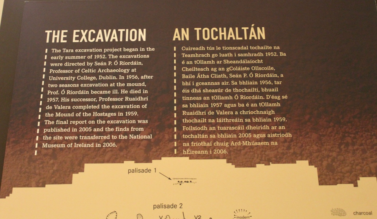
“The Hill of Tara has been important since the late Stone Age, when a passage tomb was built there. However, the site became truly significant in the Iron Age (600 BC to 400 AD) and into the Early Christian Period when it rose to supreme prominence – as the seat of the high kings of Ireland. All old Irish roads lead to this critical site.
“St Patrick himself went there in the fifth century. As Christianity achieved dominance over the following centuries, Tara’s importance became symbolic. Its halls and palaces have now disappeared and only earthworks remain.
“There are still remarkable sights to be seen, however. Just one example is the Lia Fáil – the great coronation stone and one of the four legendary treasures of the Tuatha Dé Danann – which stands proudly on the monument known as An Forradh.
“Guided tours of the site will help you understand the regal history of this exceptional place and imagine its former splendour.“
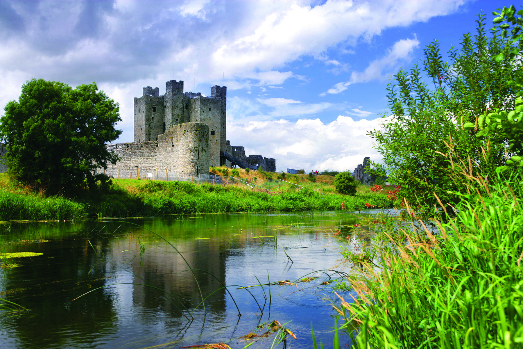
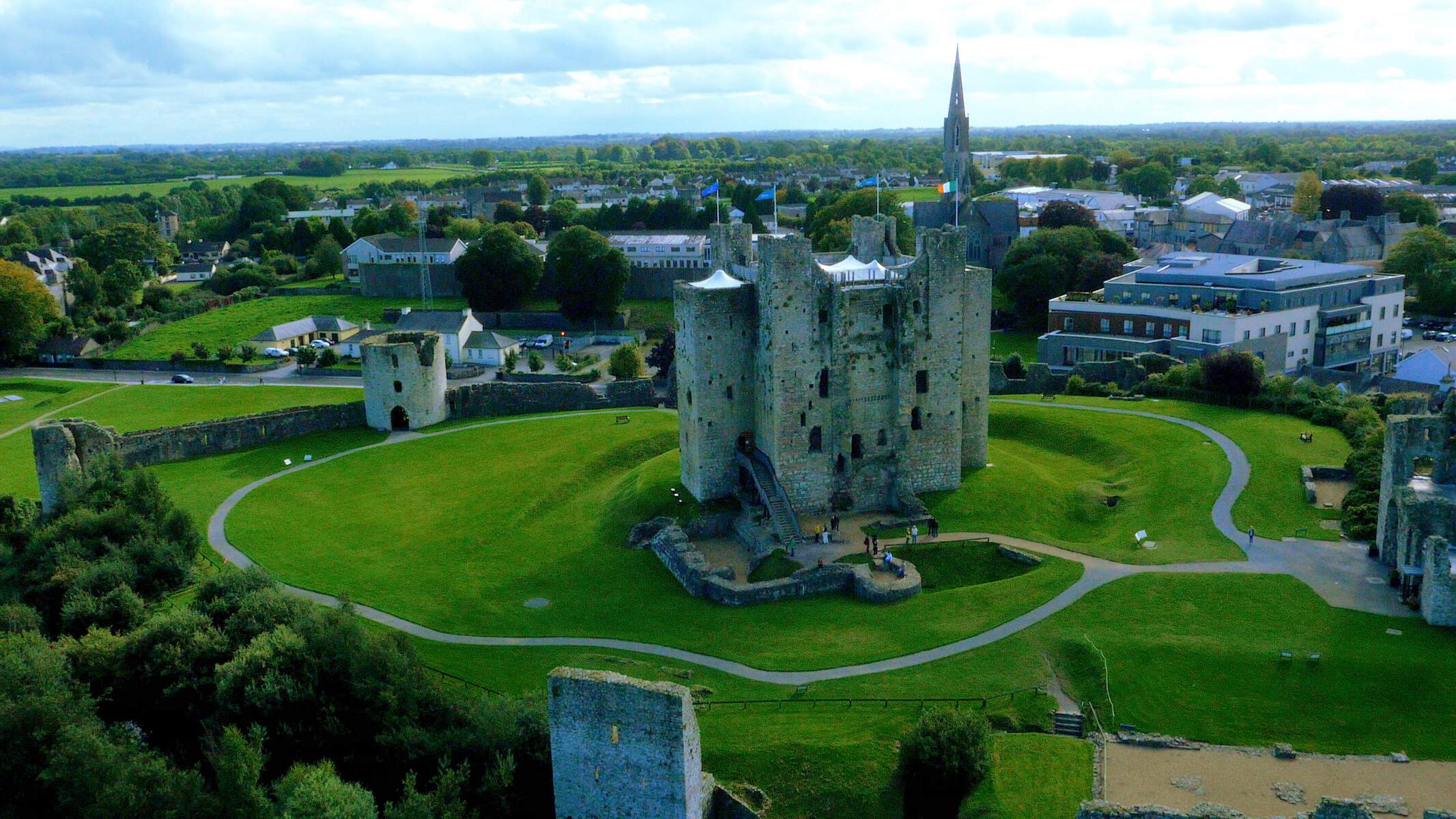
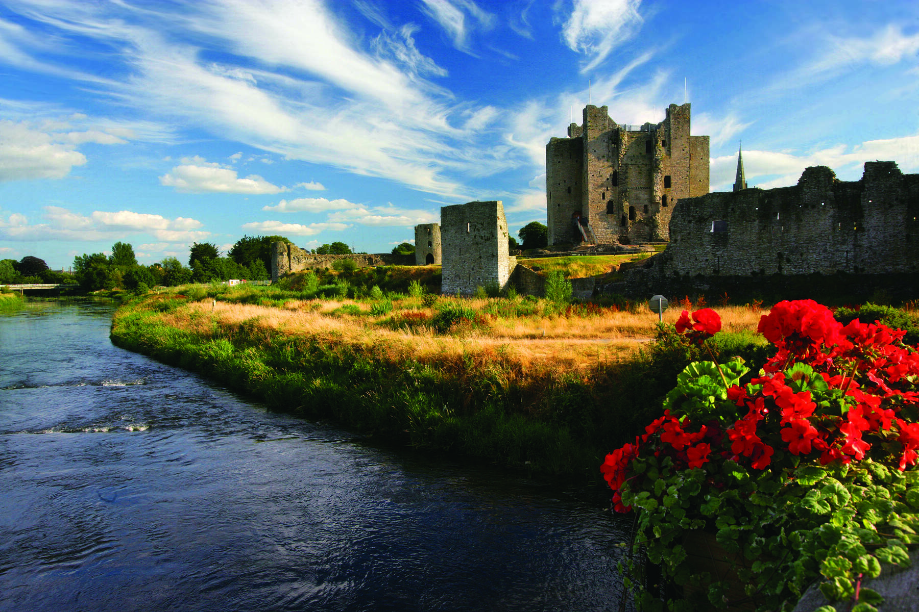
Trim Castle and the River Boyne, photograph by Brian Morrison, 2015 for Tourism Ireland, Ireland’s Content Pool. [see 6]Trim Castle and the River Boyne, photograph by macmillan media, 2015 for Tourism Ireland, Ireland’s Content Pool. [see 6]
General information: 046 943 8619, trimcastle@opw.ie
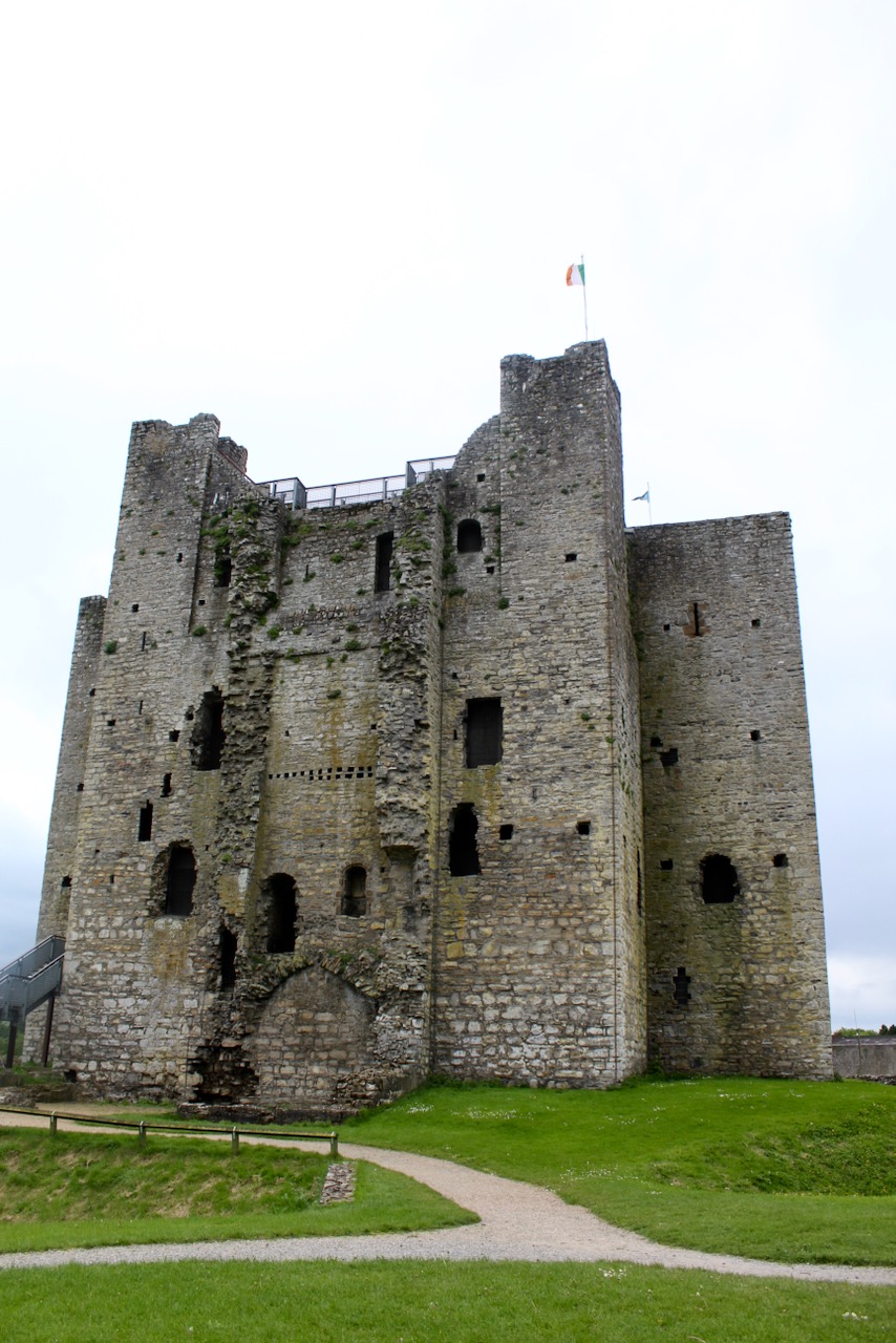
“Few places in Ireland contain more medieval buildings than the heritage town of Trim. Trim Castle is foremost among those buildings.
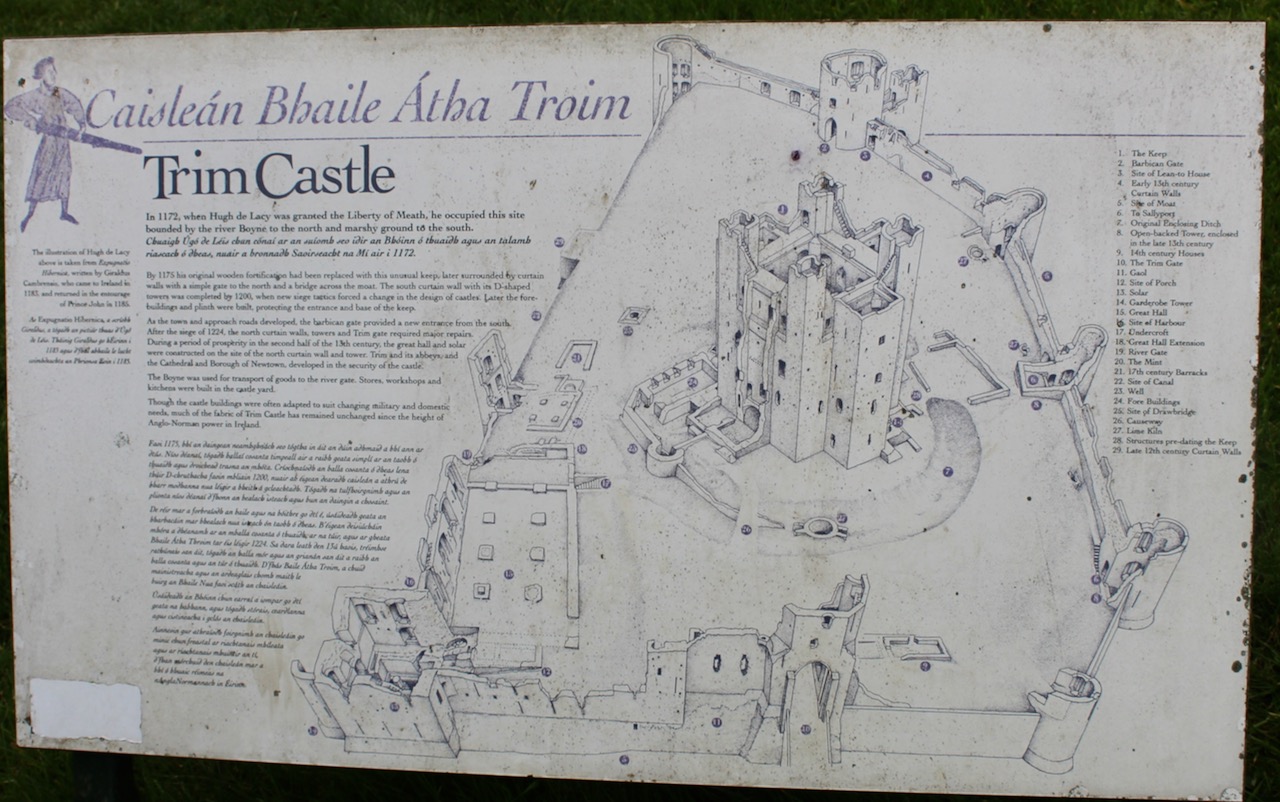
“In fact, the castle is the largest Anglo-Norman fortification in Ireland. Hugh de Lacy and his successors took 30 years to build it.
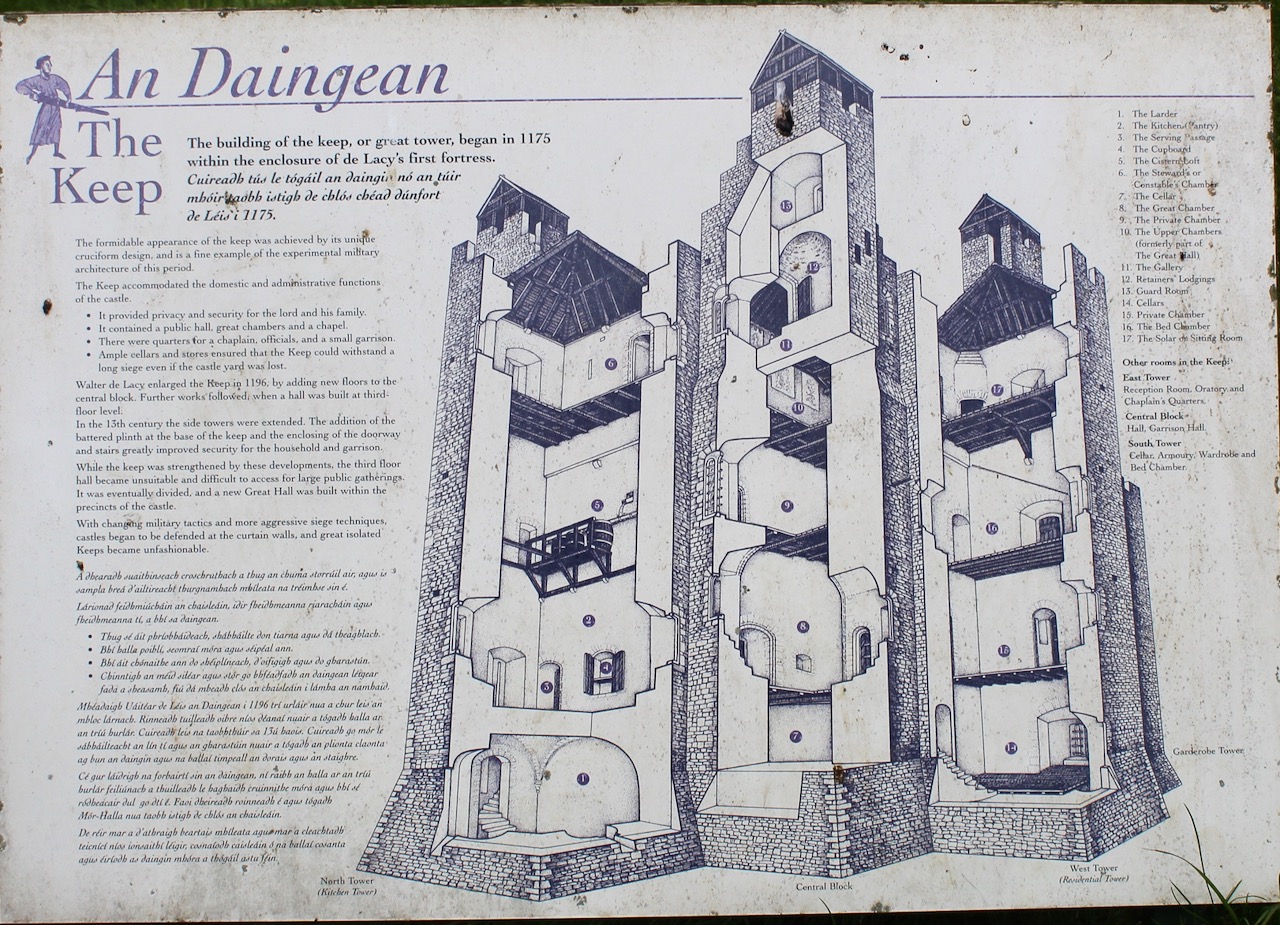
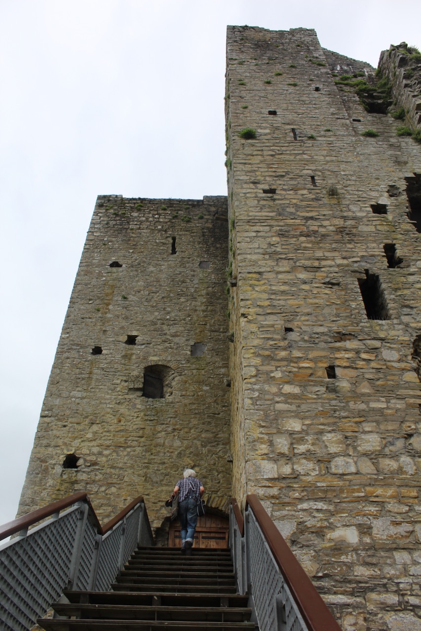
“The central fortification is a monumental three-storey keep. This massive 20-sided tower, which is cruciform in shape, was all but impregnable in its day. It was protected by a ditch, curtain wall and water-filled moat.
“Modern walkways now allow you to look down over the interior of the keep – a chance to appreciate the sheer size and thickness of the mighty castle walls.
“The castle is often called King John’s Castle although when he visited the town he preferred to stay in his tent on the other side of the river. Richard II visited Trim in 1399 and left Prince Hal later Henry V as a prisoner in the castle.” I never knew we had such a link to King Henry V and Shakespeare’s play, Henry IV!
Trim Castle and the River Boyne, photograph by Brian Morrison, 2006 for Tourism Ireland, Ireland’s Content Pool. [see 6]
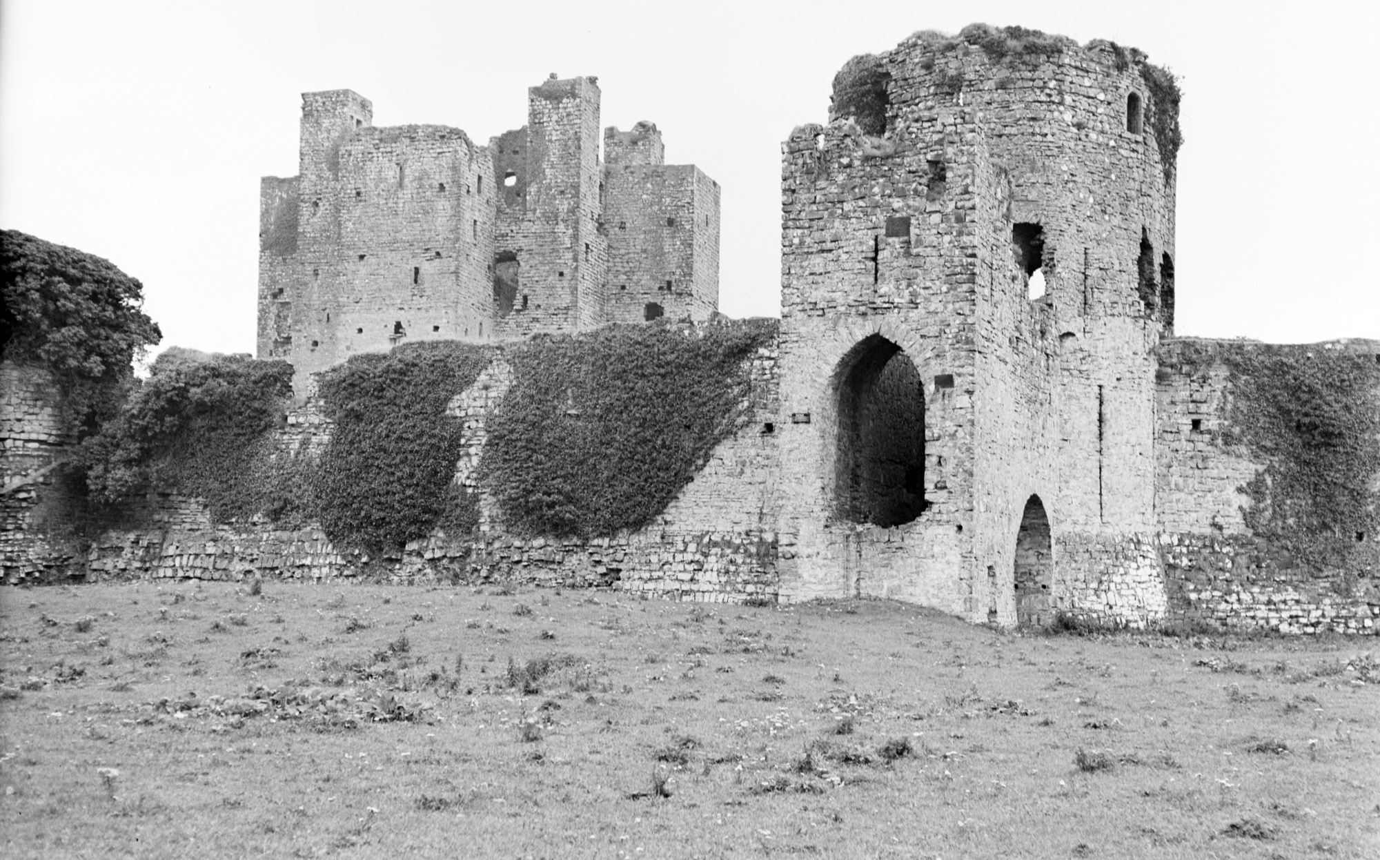
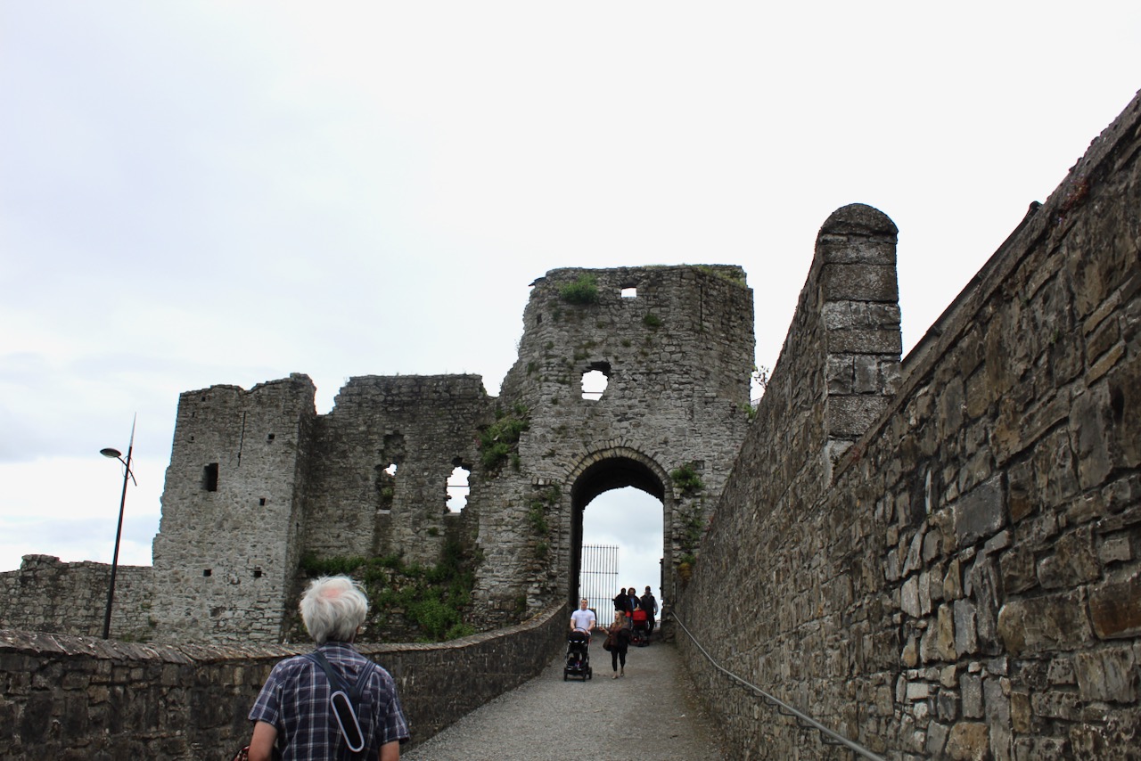
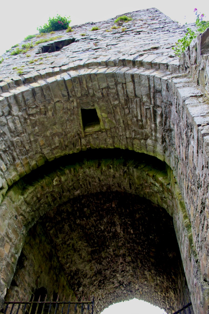
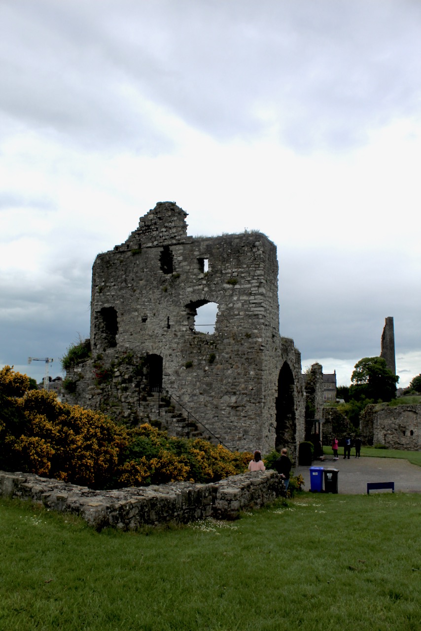
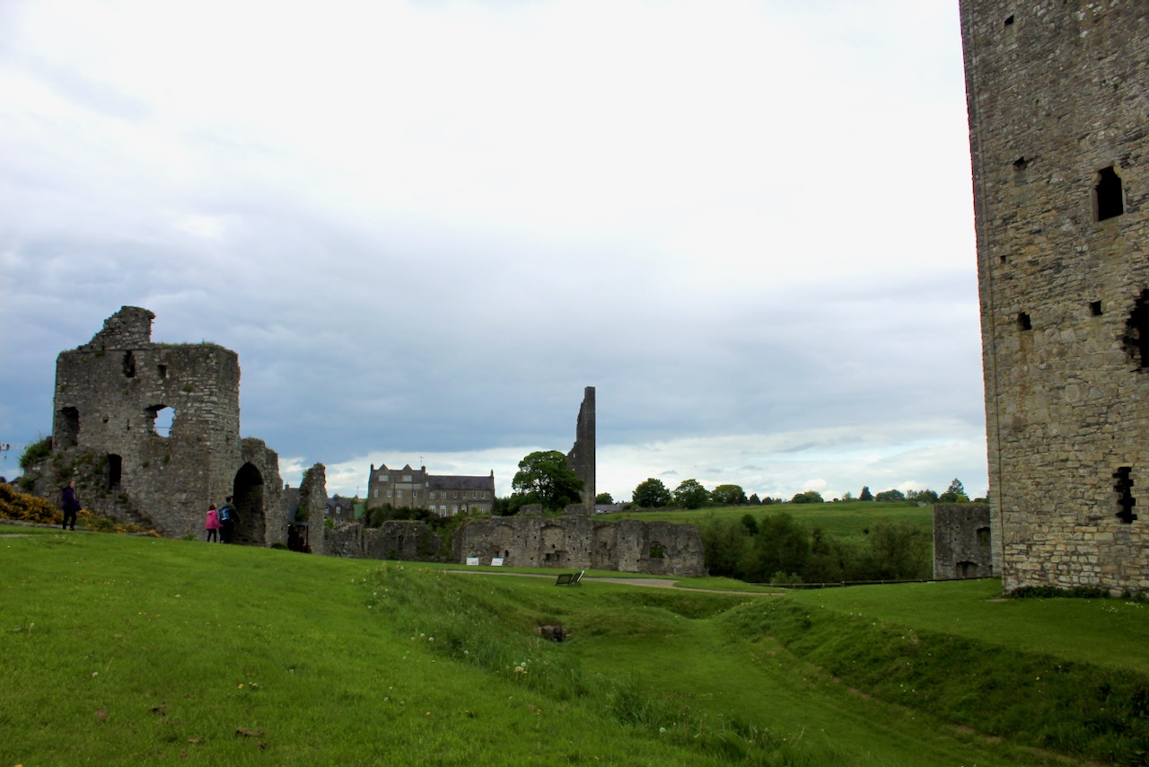
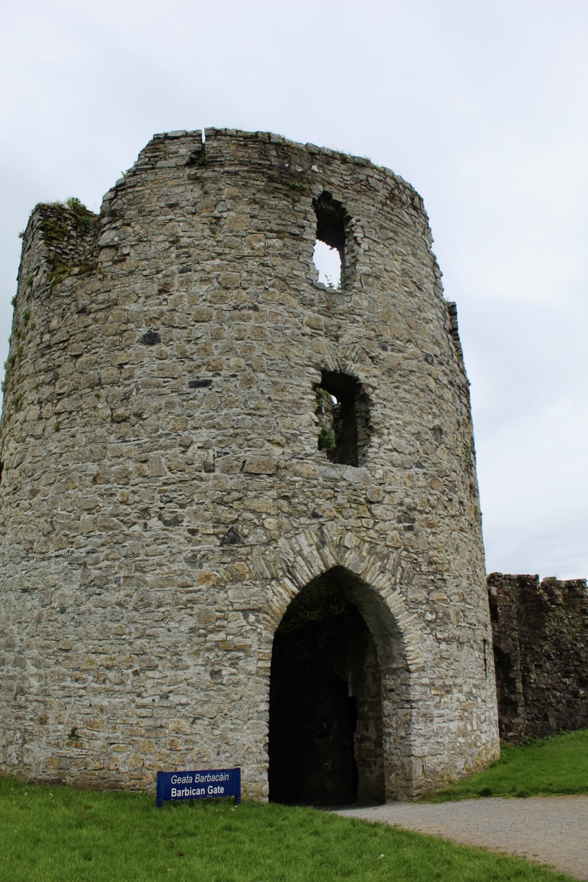
Patrick Comerford gives an excellent history of Trim Castle in his blog. [18] The castle stands within a three acre bailey, surrounded by a defensive perimeter wall. The curtain wall of the castle is fortified by a series of semicircular open-back towers. There were two entrances to Trim Castle, one, beside the car park, is flanked by a gatehouse, and the second is a barbican gate and tower. [19]
We visited in May 2022, after visiting St. Mary’s Abbey (also called Talbot’s Castle) – more on that soon. We were late entering so the entry to inside the castle was closed, unfortunately – we shall have to visit again!
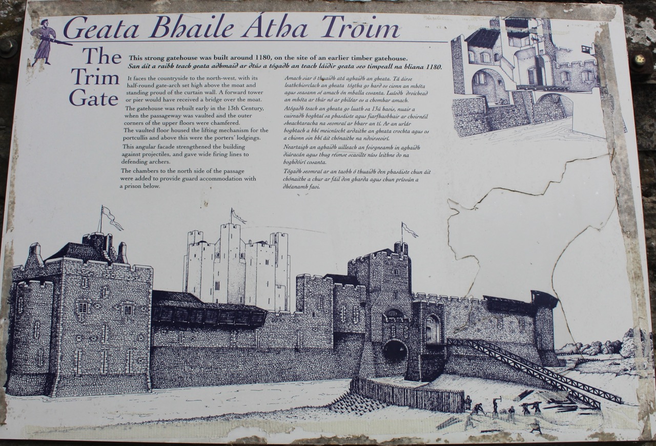
The information board tells us that in 1182 when Hugh de Lacy was granted the Liberty of Meath, he occupied this site bounded by the River Boyne to the north and marshy ground to the south. By 1175 his original wooden fortification had been replaced by this unusual keep, later surrounded by curtain walls with a simple gate to the north and a bridge across the moat. The south curtain wall with its D shaped buildings was completed by 1200, when new siege tactics forced a change in the design of castles. Later, the forebuildings and plinth were built, protecting the entrance and base of the keep.
Trim Castle, May 2022.
Sometime before 1180, Hugh de Lacy replaced the timber palisade fence enclosing the keep with a stone enclosure. The fore-court enclosed stables and stores and protected the stairway and door to the keep. The new entrance was on the north side of the enclosure and had a drawbridge over the deepened ditch.
With the development of the curtain walls, the inner enclosure became obsolete.
The ditch was filled and three defensive towers – two survive – were built on its site. The drawbridge was replaced by a stone causeway leading to an arched gate and entrance stairway. A reception hall was built to accommodate visitors before they entered the Keep.
As the town and approach roads developed, the barbican gate provided a new entrance from the south. After the siege of 1224, the north curtain walls, towers and Trim gate required major repairs. During a period of prosperity in the second half of the 13th century, the great hall and solar were constructed on the site of the north curtain wall and tower. Trim and its abbeys and the Cathedral and borough of Newtown developed in the security of the castle.
The Boyne was used for transport of goods to the river gate. Stores, workshops and kitchens were built in the castle yard.
Though the castle buildings were often adapted to suit changing military and domestic needs, much of the fabric of Trim Castle has remained unchanged since the height of Anglo-Norman power in Ireland.
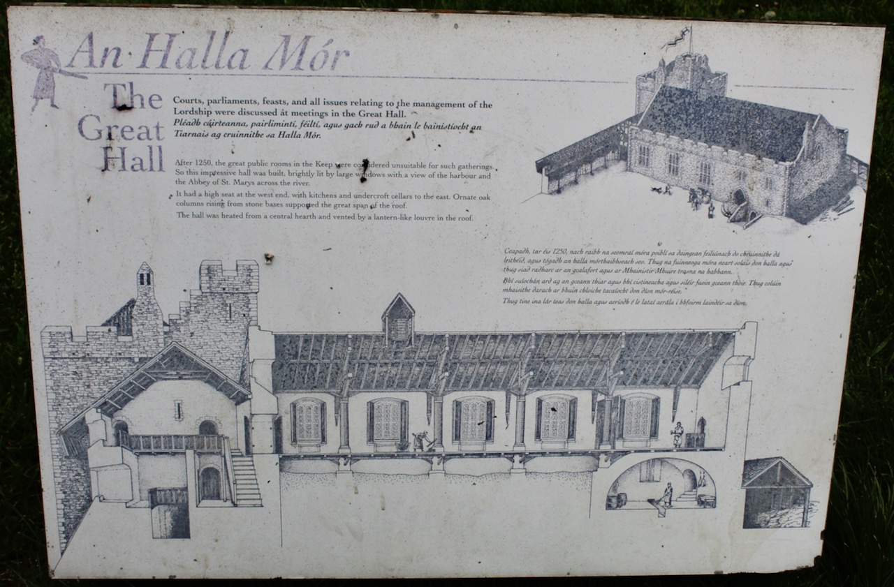
The information board tells us that courts, parliaments, feasts and all issues relating to the management of the Lordship were discussed at meetings in the Great Hall. After 1250, the great public rooms in the Keep were considered unsuitable for such gatherings, so this hall was built, lit by large windows with a view of the harbour and the Abbey of St. Mary’s across the river. The hall had a high seat at the west end, with kitchens and undercroft cellars to the east. Ornate oak columns rising from stone bases supported the great span of the roof.
The hall was heated from a central hearth and vented by a lantern-like louvre in the roof.
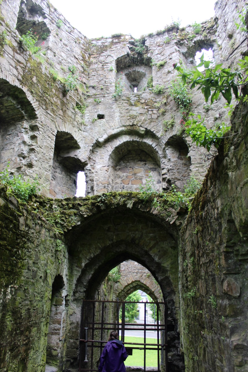
Early in the 13th century the weirs were completed on the Boyne, allowing the moat to be flooded, and the Leper River was channelled along the south curtain wall. A new gate was constructed guarding the southern approaches to the castle. This gatehouse, of a rare design, was built as a single cylindrical tower with a “barbican,” defences of a forward tower adn bridge. An elaborate system of lifting bridges, gates and overhead traps gave the garrison great control over those entering the castle. The arrangement of plunging loops demonstrates the builders’ knowledge of the military requirements of defending archers.
By the middle of the 13th century, the design of castle gates was further developed and a twin tower gatehouse with a passage between the two towers became standard.
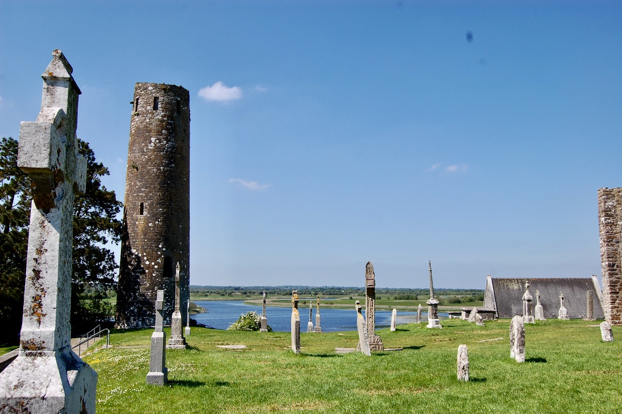
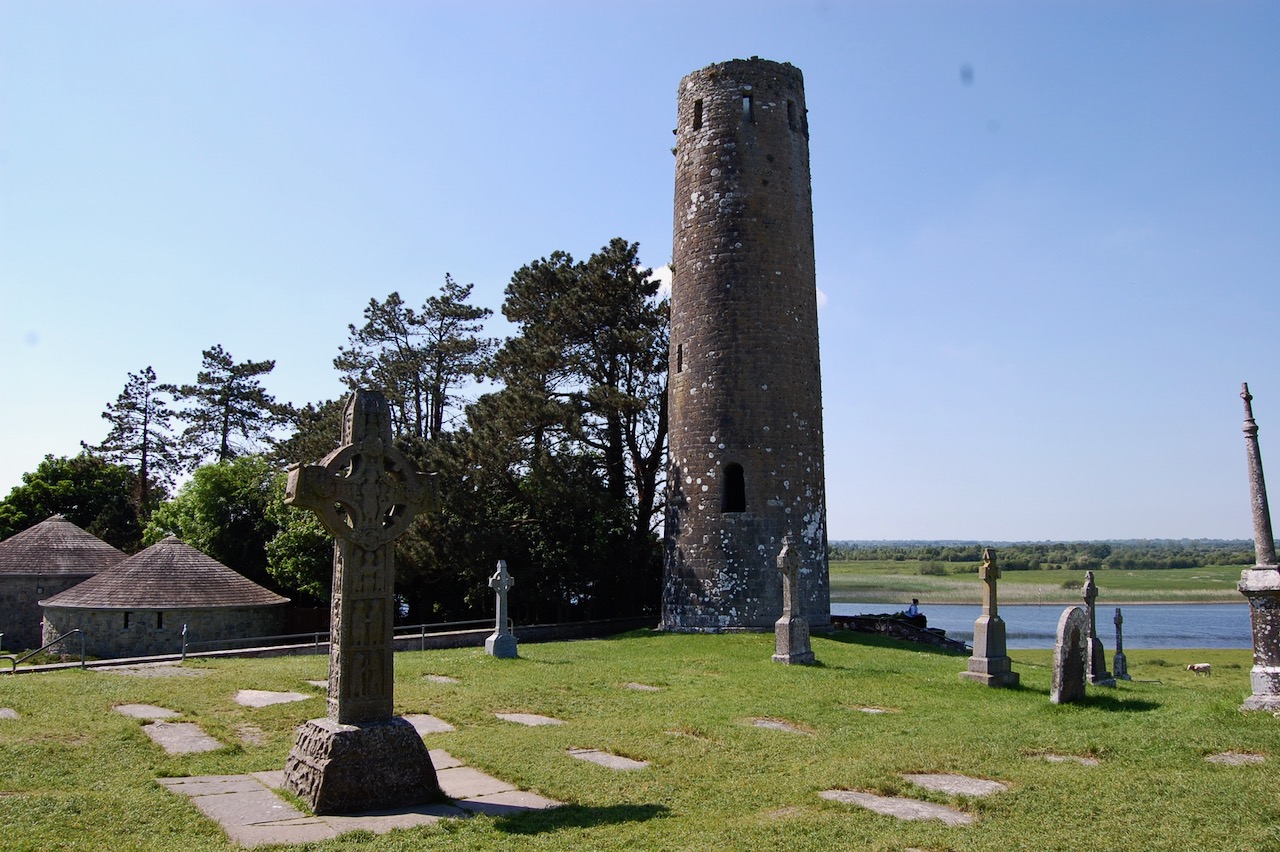
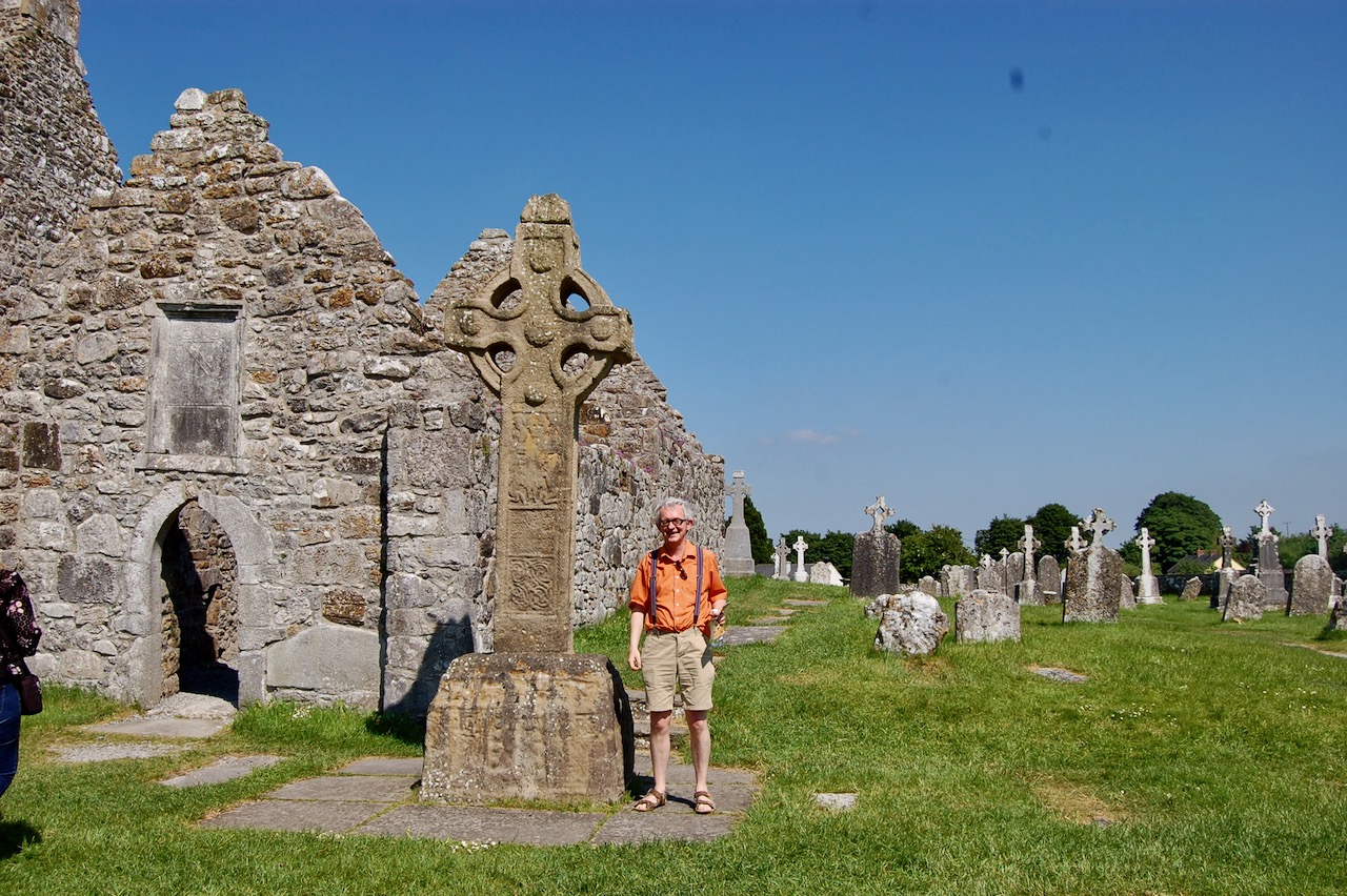
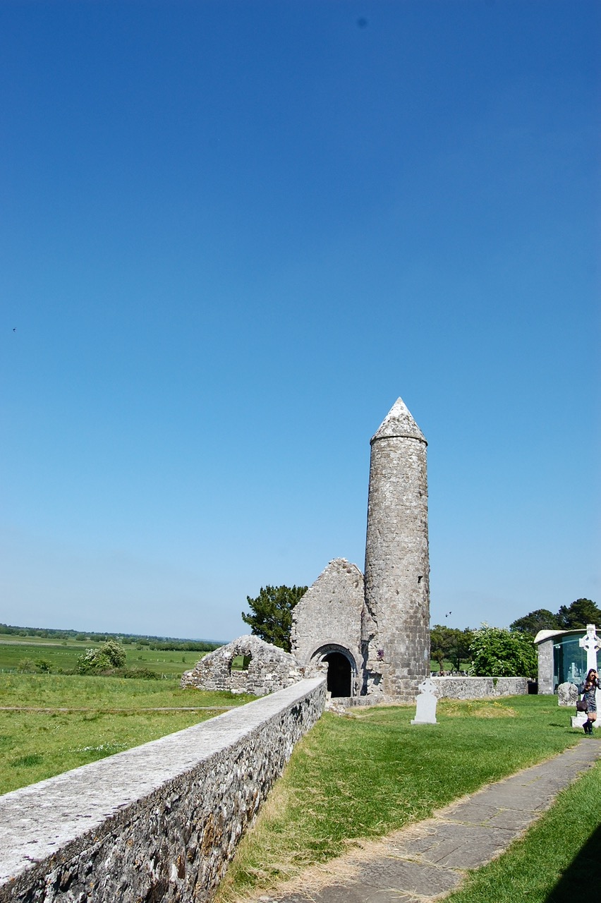
“St Ciarán founded his monastery on the banks of the River Shannon in the 6th Century. The monastery flourished and became a great seat of learning, a University of its time with students from all over Europe.
“The ruins include a Cathedral, two round Towers, three high crosses, nine Churches and over 700 Early Christian graveslabs.
“The original high crosses, including the magnificent 10th century Cross of the Scriptures area on display in a purpose built visitor centre adjacent the monastic enclosure.
“An audiovisual presentation will give you an insight into the history of this hallowed space.“
[3] p. 119. Bence-Jones, Mark. A Guide to Irish Country Houses (originally published as Burke’s Guide to Country Houses volume 1 Ireland by Burke’s Peerage Ltd. 1978); Revised edition 1988, Constable and Company Ltd, London.
Canonbrook, Lucan: “Detached multiple-bay two-storey over basement house, c.1800, on an L-plan. A handsome, substantial rural Georgian house which, though altered, retains its imposing form and feel, and is situated in mature grounds. Historically important as the former home of James Gandon.”Gandon is also said to have designed Primrose Hill House in Lucan, which is a section 482 property.
[9] p. 96. Sadleir, Thomas U. and Page L. Dickinson. Georgian Mansions in Ireland with some account of the evolution af Georgian Architecture and Decoration. Dublin University Press, 1915.
[10] p. 356. Tierney, Andrew. The Buildings of Ireland: Central Leinster: Kildare, Laois and Offaly. Yale University Press, New Haven and London, 2019.
[11] p. 61. O’Reilly, Sean. Irish Houses and Gardens. From the Archives of Country Life. Aurum Press Ltd, London, 1998.
[13] p. 175, Casey, Christine and Alistair Rowan. The Buildings of Ireland: North Leinster: the counties of Longford, Louth, Meath and Westmeath. Penguin Books, London, 1993.
[14] p. 387, Casey, Christine and Alistair Rowan. The Buildings of Ireland: North Leinster: the counties of Longford, Louth, Meath and Westmeath. Penguin Books, London, 1993.
[19] p. 511, Casey, Christine and Alistair Rowan. The Buildings of Ireland: North Leinster: the counties of Longford, Louth, Meath and Westmeath. Penguin Books, London, 1993.